Filter
25
Featured
15
Language
Document type
18
6
1
Countries
8
6
3
3
2
2
2
2
1
1
1
1
1
1
Authors & Publishers
Publication Years
Category
19
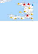
The PREVIEW Global Risk Data Platform is a multiple agencies effort to share spatial data information on global risk from natural hazards. Users can visualise, download or extract data on past hazardous events, human & economical hazard exposure and risk from natural hazards. It covers tropical cycl
...
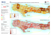
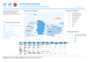
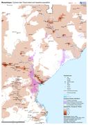
Baseline total population and population density in Communes in earthquake affected areas, together with earthquake shake map
The European Commission allocated an emergency aid package of €3.5 million on 19/03. The funding will be used to provide logistical support to reach affected people, emergency shelter, hygiene, sanitation, and health care. Out of the aid package, based on needs, €2 million will be provided in Mo
...
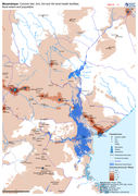
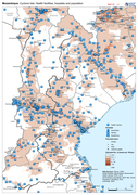
Map shows the population (based on WorldPop at 100m resolution generating through AI) and the Flood Extents known as of 19/20 March 2019 plus Health facilities
Map shows the population (based on WorldPop at 100m resolution generating through AI) and the Flood Extents known as of 19/20 March 2019
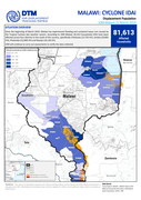
Since the beginning of March 2019, Malawi has experienced flooding and sustained heavy rain caused by the Tropical Cyclone Idai weather system. According to IOM Malawi, 81,613 households (HH) have been affected across four districts in the south of the country, specifically Chikwawa (12,755 HH), Zom
...
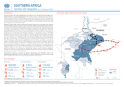
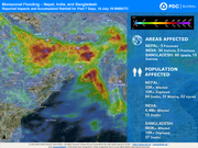
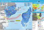
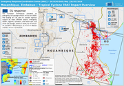
Flooding caused by the Tropical Cyclone Idai weather system since early March has affected nearly 3 million people and caused at least 678 deaths in Malawi, Mozambique and Zimbabwe.
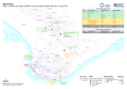
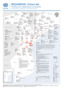
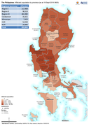
Mozambique: Cyclone Idai Responding Organisations Presence (Completed and ongoing as of 18 April 2019)