Filter
6033
Text search:
population
survey
Featured
333
1917
Language
5648
255
103
85
36
34
31
16
11
7
6
5
4
3
3
2
2
2
2
2
2
2
2
2
2
2
2
2
2
2
1
1
1
1
1
1
1
1
1
1
1
1
1
1
1
1
1
1
1
1
1
1
1
1
1
Document type
3910
1131
390
196
179
113
44
39
17
6
5
2
Countries
243
232
186
181
180
155
141
135
128
126
124
118
112
108
107
105
99
96
89
81
80
77
75
74
68
66
64
64
63
60
47
45
42
41
41
41
39
35
35
31
31
30
28
27
25
25
25
25
23
22
21
19
19
18
17
15
15
15
14
14
13
12
12
11
11
11
10
9
9
9
8
8
8
8
8
8
8
7
7
7
6
6
5
5
5
5
5
5
5
5
4
4
4
4
4
4
4
4
4
3
3
3
3
3
3
3
3
3
3
3
3
2
2
2
2
2
2
2
2
2
2
2
2
2
2
2
2
2
2
2
1
1
1
1
1
1
1
1
1
1
1
1
1
1
1
1
1
1
1
1
Authors & Publishers
561
307
237
225
145
145
142
105
92
55
53
43
34
34
34
32
31
29
28
25
24
24
22
22
22
22
21
21
20
20
20
20
19
19
18
18
18
17
17
16
16
16
16
16
16
16
16
15
15
15
15
14
14
14
14
14
14
13
13
12
12
12
11
11
11
11
11
11
10
10
10
10
10
10
10
10
9
9
9
9
9
9
9
9
9
9
9
9
8
8
8
8
8
8
8
8
8
8
8
7
7
7
7
7
7
7
7
7
7
7
7
7
7
7
7
7
6
6
6
6
6
6
6
6
6
6
6
6
6
6
6
6
6
6
6
6
6
6
6
6
6
6
6
6
6
6
6
6
6
6
6
5
5
5
5
5
5
5
5
5
5
5
5
5
5
5
5
5
5
5
5
5
5
5
5
5
5
5
5
5
5
5
5
5
5
5
5
5
5
5
5
5
5
5
5
5
5
5
5
5
5
5
5
4
4
4
4
4
4
4
4
4
4
4
4
4
4
4
4
4
4
4
4
4
4
4
4
4
4
4
4
4
4
4
4
4
4
4
4
4
4
4
4
4
4
4
4
4
4
4
4
4
4
4
4
4
4
4
4
4
4
4
4
4
4
4
4
4
4
4
4
4
4
4
4
4
4
4
4
4
4
3
3
3
3
3
3
3
3
3
3
3
3
3
3
3
3
3
3
3
3
3
3
3
3
3
3
3
3
3
3
3
3
3
3
3
3
3
3
3
3
3
3
3
3
3
3
3
3
3
3
3
3
3
3
3
3
3
3
3
3
3
3
3
3
3
3
3
3
3
3
3
3
3
3
3
3
3
3
3
3
3
3
3
3
3
3
3
3
3
3
3
3
3
3
3
3
3
3
3
3
3
3
3
3
3
3
3
3
3
3
3
3
3
3
3
3
3
3
3
3
3
3
3
3
3
3
2
2
2
2
2
2
2
2
2
2
2
2
2
2
2
2
2
2
2
2
2
2
2
2
2
2
2
2
2
2
2
2
2
2
2
2
2
2
2
2
2
2
2
2
2
2
2
2
2
2
2
2
2
2
2
2
2
2
2
2
2
2
2
2
2
2
2
2
2
2
2
2
2
2
2
2
2
2
2
2
2
2
2
2
2
2
2
2
2
2
2
2
2
2
2
2
2
2
2
2
2
2
2
2
2
2
2
2
2
2
2
2
2
2
2
2
2
2
2
2
2
2
2
2
2
2
2
2
2
2
2
2
2
2
2
2
2
2
2
2
2
2
2
2
2
2
2
2
2
2
2
2
2
2
2
2
2
2
2
2
2
2
2
2
2
2
2
2
2
2
2
2
2
2
2
2
2
2
2
2
2
2
2
2
2
2
2
2
2
2
2
2
2
2
2
2
2
2
2
2
2
2
2
2
2
2
2
2
2
2
2
2
2
2
2
2
2
2
2
2
2
2
2
2
2
2
2
2
2
2
2
2
2
2
2
2
2
2
2
2
2
2
2
2
2
2
2
2
2
2
2
2
2
2
2
2
2
2
2
2
2
2
2
2
2
2
2
2
2
2
2
2
2
2
2
2
2
2
2
2
2
2
2
2
2
2
2
2
2
2
2
2
2
2
2
2
2
2
2
2
2
2
2
2
2
2
2
2
2
2
2
2
2
2
2
2
2
2
2
2
2
2
2
2
2
2
2
2
2
2
2
2
2
2
2
2
2
2
2
2
2
2
2
2
2
2
2
2
2
2
2
2
2
2
2
2
2
2
2
2
2
2
2
2
2
2
2
2
2
2
2
2
2
2
2
2
2
2
2
2
1
1
1
1
1
1
1
1
1
1
1
1
1
1
1
1
1
1
1
1
1
1
1
1
1
1
1
1
1
1
1
1
1
1
1
1
1
1
1
1
1
1
1
1
1
1
1
1
1
1
1
1
1
1
1
1
1
1
1
1
1
1
1
1
1
1
1
1
1
1
1
1
1
1
1
1
1
1
1
1
1
1
1
1
1
1
1
1
1
1
1
1
1
1
1
1
1
1
1
1
1
1
1
1
1
1
1
1
1
1
1
1
1
1
1
1
1
1
1
1
1
1
1
1
1
1
1
1
1
1
1
1
1
1
1
1
1
1
1
1
1
1
1
1
1
1
1
1
1
1
1
1
1
1
1
1
1
1
1
1
1
1
1
1
1
1
1
1
1
1
1
1
1
1
1
1
1
1
1
1
1
1
1
1
1
1
1
1
1
1
1
1
1
1
1
1
1
1
1
1
1
1
1
1
1
1
1
1
1
1
1
1
1
1
1
1
1
1
1
1
1
1
1
1
1
1
1
1
1
1
1
1
1
1
1
1
1
1
1
1
1
1
1
1
1
1
1
1
1
1
1
1
1
1
1
1
1
1
1
1
1
1
1
1
1
1
1
1
1
1
1
1
1
1
1
1
1
1
1
1
1
1
1
1
1
1
1
1
1
1
1
1
1
1
1
1
1
1
1
1
1
1
1
1
1
1
1
1
1
1
1
1
1
1
1
1
1
1
1
1
1
1
1
1
1
1
1
1
1
1
1
1
1
1
1
1
1
1
1
1
1
1
1
1
1
1
1
1
1
1
1
1
1
1
1
1
1
1
1
1
1
1
1
1
1
1
1
1
1
1
1
1
1
1
1
1
1
1
1
1
1
1
1
1
1
1
1
1
1
1
1
1
1
1
1
1
1
1
1
1
1
1
1
1
1
1
1
1
1
1
1
1
1
1
1
1
1
1
1
1
1
1
1
1
1
1
1
1
1
1
1
1
1
1
1
1
1
1
1
1
1
1
1
1
1
1
1
1
1
1
1
1
1
1
1
1
1
1
1
1
1
1
1
1
1
1
1
1
1
1
1
1
1
1
1
1
1
1
1
1
1
1
1
1
1
1
1
1
1
1
1
1
1
1
1
1
1
1
1
1
1
1
1
1
1
1
1
1
1
1
1
1
1
1
1
1
1
1
1
1
1
1
1
1
1
1
1
1
1
1
1
1
1
1
1
1
1
1
1
1
1
1
1
1
1
1
1
1
1
1
1
1
1
1
1
1
1
1
1
1
1
1
1
1
1
1
1
1
1
1
1
1
1
1
1
1
1
1
1
1
1
1
1
1
1
1
1
1
1
1
1
1
1
1
1
1
1
1
1
1
1
1
1
1
1
1
1
1
1
1
1
1
1
1
1
1
1
1
1
1
1
1
1
1
1
1
1
1
1
1
1
1
1
1
1
1
1
1
1
1
1
1
1
1
1
1
1
1
1
1
1
1
1
1
1
1
1
1
1
1
1
1
1
1
1
1
1
1
1
1
1
1
1
1
1
1
1
1
1
1
1
1
1
1
1
1
1
1
1
1
1
1
1
1
1
1
1
1
1
1
1
1
1
1
1
1
1
1
1
1
1
1
1
1
1
1
1
1
1
1
1
1
1
1
1
1
1
1
1
1
1
1
1
1
1
1
1
1
1
1
1
1
1
1
1
1
1
1
1
1
1
1
1
1
1
1
1
1
1
1
1
1
1
1
1
1
1
1
1
1
1
1
1
1
1
1
1
1
1
1
1
1
1
1
1
1
1
1
1
1
1
1
1
1
1
1
1
1
1
1
1
1
1
1
1
1
1
1
1
1
1
1
1
1
1
1
1
1
1
1
1
1
1
1
1
1
1
1
1
1
1
1
1
1
1
1
1
1
1
1
1
1
1
1
1
1
1
1
1
1
1
1
1
1
1
1
1
1
1
1
1
1
1
1
1
1
1
1
1
1
1
1
1
1
1
1
1
1
1
1
1
1
1
1
1
1
1
1
1
1
1
1
1
1
1
1
1
1
1
1
1
1
1
1
1
1
1
1
1
1
1
1
1
1
1
1
1
1
1
1
1
1
1
1
1
1
1
1
1
1
1
1
1
1
1
1
1
1
1
1
1
1
1
1
1
1
1
1
1
1
1
1
1
1
1
1
1
1
1
1
1
1
1
1
1
1
1
1
1
1
1
1
1
1
1
1
1
1
1
1
1
1
1
1
1
1
1
1
1
1
1
1
1
1
1
1
1
1
1
1
1
1
1
1
1
1
1
1
1
1
1
1
1
1
1
1
1
1
1
1
1
1
1
1
1
1
1
1
1
1
1
1
1
1
1
1
1
1
1
1
1
1
1
1
1
1
1
1
1
1
1
1
1
1
1
1
1
1
1
1
1
1
1
1
1
1
1
1
1
1
1
1
1
1
1
1
1
1
1
1
1
1
1
1
1
1
1
1
1
1
1
1
1
1
1
1
1
1
1
1
1
1
1
1
1
1
1
1
1
1
1
1
1
1
1
1
1
1
1
1
1
1
1
1
1
1
1
1
1
1
1
1
1
1
1
1
1
1
1
1
1
1
1
1
1
1
1
1
1
1
1
1
1
1
1
1
1
1
1
1
1
1
1
1
1
1
1
1
1
1
1
1
1
1
1
1
1
1
1
1
1
1
1
1
1
1
1
1
1
1
1
1
1
1
1
1
1
1
1
1
1
1
1
1
1
1
1
1
1
1
1
1
1
1
1
1
1
1
1
1
1
1
1
1
1
1
1
1
1
1
1
1
1
1
1
1
1
1
1
1
1
1
1
1
1
1
1
1
1
1
1
1
1
1
1
1
1
1
1
1
1
1
1
1
1
1
1
1
1
1
1
1
1
1
1
1
1
1
1
1
1
1
1
1
1
1
1
1
1
1
1
1
1
1
1
1
1
1
1
1
1
1
1
1
1
1
1
1
1
1
1
1
1
1
1
1
1
1
1
1
1
1
1
1
1
1
1
1
1
1
1
1
1
1
1
1
1
1
1
1
1
1
1
1
1
1
1
1
1
1
1
1
1
1
1
1
1
1
1
1
1
1
1
1
1
1
1
1
1
1
1
1
1
1
1
1
1
1
1
1
1
1
1
1
1
1
1
1
1
1
1
1
1
1
1
1
1
1
1
1
1
1
1
1
1
1
1
1
1
1
1
1
1
1
1
1
1
1
1
1
1
1
1
1
1
1
1
1
1
1
1
1
1
1
1
1
1
1
1
1
1
1
1
1
1
1
1
1
1
1
1
1
1
1
1
1
1
1
1
1
1
1
1
1
1
1
1
1
1
1
1
1
1
1
1
1
1
1
1
1
1
1
1
1
1
1
1
1
1
1
1
1
1
1
1
1
1
1
1
1
1
1
1
1
1
1
1
1
1
1
1
1
1
1
1
1
1
1
1
1
1
1
1
1
1
1
1
1
1
1
1
1
1
1
1
1
1
1
1
1
1
1
1
1
1
1
1
1
1
1
1
1
1
1
1
1
1
1
1
1
1
1
1
1
1
1
1
1
1
1
1
1
1
1
1
1
1
1
1
1
1
1
1
1
1
1
1
1
1
1
1
1
1
1
1
1
1
1
1
1
1
1
1
1
1
1
1
1
1
1
1
1
1
1
1
1
1
1
1
1
1
1
1
1
1
1
1
1
1
1
1
1
1
1
1
1
1
1
1
1
1
1
1
1
1
1
1
1
1
1
1
1
1
1
1
1
1
1
1
1
1
1
1
1
1
1
1
1
1
1
1
1
1
1
1
1
1
1
1
1
1
1
1
1
1
1
1
1
1
1
1
1
1
1
1
1
1
1
1
1
1
1
1
1
1
1
1
1
1
1
1
1
1
1
1
1
1
1
1
1
1
1
1
1
1
1
1
1
1
1
1
1
1
1
1
1
1
1
1
1
1
1
1
1
1
1
1
1
1
1
1
1
1
1
1
1
1
1
1
1
1
1
1
1
1
1
1
1
1
1
1
1
1
1
1
1
1
1
1
1
1
1
1
1
1
1
1
1
1
1
1
1
1
1
1
1
1
1
1
1
1
1
1
1
1
1
1
1
1
1
1
1
1
1
1
1
1
1
1
1
1
1
1
1
1
1
1
1
1
1
1
1
1
1
1
1
1
1
1
1
1
1
1
1
1
1
1
1
1
1
1
1
1
1
1
1
1
1
1
1
1
1
1
1
1
1
1
1
1
1
1
1
1
1
1
1
1
1
1
1
1
1
1
1
1
1
1
1
1
1
1
1
1
1
1
1
1
1
1
1
1
1
1
1
1
1
1
1
1
1
1
1
1
1
1
1
1
1
1
1
1
1
1
1
1
1
1
1
1
1
1
1
1
1
1
1
1
1
1
1
1
1
1
1
1
1
1
1
1
1
1
1
1
1
1
1
1
1
1
1
1
1
1
1
1
1
1
1
1
1
1
1
1
1
1
1
1
1
1
1
1
1
1
1
1
1
1
1
1
1
1
1
1
1
1
1
1
1
1
1
1
1
1
1
1
1
1
1
1
1
1
1
1
1
1
1
1
1
1
1
1
1
1
1
1
1
1
1
1
1
1
1
1
1
1
1
1
1
1
1
1
1
1
1
1
1
1
1
1
1
1
1
1
1
1
1
1
1
1
1
1
1
1
1
1
1
1
1
1
1
1
1
1
1
1
1
1
1
1
1
1
1
1
1
1
1
1
1
1
1
1
1
1
1
1
1
1
1
1
1
1
1
1
1
1
1
1
1
1
1
1
1
1
1
1
1
1
1
1
1
1
1
1
1
1
1
1
1
1
1
1
1
1
1
1
1
1
1
1
1
1
1
1
1
1
1
1
1
1
1
1
1
1
1
1
1
1
1
1
1
1
1
1
1
1
1
1
1
1
1
1
1
1
1
1
1
1
1
1
1
1
1
1
1
1
1
1
1
1
1
1
1
1
1
1
1
1
1
1
1
1
1
1
1
1
1
1
1
1
1
1
1
1
1
1
1
1
1
1
1
1
1
1
1
1
1
1
1
1
1
1
1
1
1
1
1
1
1
1
1
1
1
1
1
1
1
1
1
1
1
1
1
1
1
1
1
1
1
1
1
1
1
1
1
1
1
1
1
1
1
1
1
1
1
1
1
1
1
1
1
1
1
1
1
1
1
1
1
1
1
1
1
1
1
1
1
1
1
1
1
1
1
1
1
1
1
1
1
1
1
1
1
1
1
1
1
1
1
1
1
1
1
1
1
1
1
1
1
1
1
1
1
1
1
1
1
1
1
1
1
1
1
1
1
1
1
1
1
1
1
1
1
1
1
1
1
1
1
1
1
1
1
1
1
1
1
1
1
1
1
1
1
1
1
1
1
1
1
1
1
1
1
1
1
1
1
1
1
1
1
1
1
1
1
1
1
1
1
1
1
1
1
1
1
1
1
1
1
1
1
1
1
1
1
1
1
1
1
1
1
1
1
1
1
1
1
1
1
1
1
1
1
1
1
1
1
1
1
1
1
1
1
1
1
1
1
1
1
1
1
1
1
1
1
1
1
1
1
1
1
1
1
1
1
1
1
1
1
1
1
1
1
1
1
1
1
1
1
1
1
1
1
1
1
1
1
1
1
1
1
1
1
1
1
1
1
1
1
1
1
1
1
1
1
1
1
1
1
1
1
1
1
1
1
1
1
1
1
1
1
1
1
1
1
1
1
1
1
1
1
1
1
1
1
1
1
1
1
1
1
1
1
1
1
1
1
1
1
1
1
1
1
1
1
1
1
1
1
1
1
1
1
1
1
1
1
1
1
1
1
1
1
1
1
1
1
1
1
1
1
1
1
1
1
1
1
1
1
1
1
1
1
1
1
1
1
1
1
1
1
1
1
1
1
1
1
1
1
1
1
1
1
1
1
1
1
1
1
1
1
1
1
1
1
1
1
1
1
1
1
1
1
1
1
1
1
1
1
1
1
1
1
1
1
1
1
1
1
1
1
1
1
1
1
1
1
1
1
1
1
1
1
1
1
1
1
1
1
1
1
1
1
1
1
1
1
1
1
1
1
1
1
1
1
1
1
1
1
1
1
1
1
1
1
1
1
1
1
1
1
1
1
1
1
1
1
1
1
1
1
1
1
1
1
1
1
1
1
1
1
1
1
1
1
1
1
1
1
1
1
1
1
1
1
1
1
1
1
1
1
1
1
1
1
1
1
1
1
1
1
1
1
1
1
1
1
1
1
1
1
1
1
1
1
1
1
1
1
1
1
1
1
1
1
1
1
1
1
1
1
1
1
1
1
1
1
1
1
1
1
1
1
1
1
1
1
1
1
1
1
1
1
1
1
1
1
1
1
1
1
1
1
1
1
1
1
1
1
1
1
1
1
1
1
1
1
1
1
1
1
1
1
1
1
1
1
1
1
1
1
1
1
1
1
1
1
1
1
1
1
1
1
1
1
1
1
1
1
1
1
1
1
1
1
1
1
1
1
1
1
1
1
1
1
1
1
1
1
1
1
1
1
1
1
1
1
1
1
1
1
1
1
1
1
1
1
1
1
1
1
1
1
1
1
1
1
1
1
1
1
1
1
1
1
1
1
1
1
1
1
1
1
1
1
1
1
1
1
1
1
1
1
1
1
1
1
1
1
1
1
1
1
1
1
1
1
1
1
1
1
1
1
1
1
1
1
1
1
1
1
1
1
1
1
1
1
1
1
1
1
1
1
1
1
1
1
1
1
1
1
1
1
1
1
1
1
1
1
1
1
1
1
1
1
1
1
1
1
1
1
1
1
1
1
1
1
1
1
1
1
1
1
1
1
1
1
1
1
1
1
1
1
1
1
1
1
1
1
1
1
1
1
1
1
1
1
1
1
1
1
1
1
1
1
1
1
1
1
1
1
1
1
1
1
1
1
1
1
1
1
1
1
1
1
1
1
1
1
1
1
1
1
1
1
1
1
1
1
1
1
1
1
1
1
1
1
1
1
1
1
1
1
1
1
1
1
1
1
1
1
1
1
1
1
1
1
1
1
1
1
1
1
1
1
1
1
1
1
1
1
1
1
1
1
1
1
1
1
1
1
1
1
1
1
1
1
1
1
1
1
1
1
1
1
1
1
1
1
1
1
1
1
1
1
1
1
1
1
1
1
1
1
1
1
1
1
1
1
1
1
1
1
1
1
1
1
1
1
1
1
1
1
1
1
1
1
1
1
1
1
1
1
1
1
1
1
1
1
1
1
1
1
1
1
1
1
1
1
1
1
1
1
1
1
1
1
1
1
1
1
1
1
1
1
1
1
1
1
1
1
1
1
1
1
1
1
1
1
1
1
1
1
1
1
1
1
1
1
1
1
1
1
1
1
1
1
1
1
1
1
1
1
1
1
1
1
1
1
1
1
1
1
1
1
1
1
1
1
1
1
1
1
1
1
1
1
1
1
1
1
1
1
1
1
1
1
1
1
1
1
1
1
1
1
1
1
1
1
1
1
1
1
1
1
1
1
1
1
1
1
1
1
1
1
1
1
1
1
1
1
1
1
1
1
1
1
1
1
1
1
1
1
1
1
1
1
1
1
1
1
1
1
1
1
1
1
1
1
1
1
1
1
1
1
1
1
1
1
1
1
1
1
1
1
1
1
1
1
1
1
1
1
1
1
1
1
1
1
1
1
1
1
1
1
1
1
1
1
1
1
1
1
1
1
1
1
1
1
1
1
1
1
1
1
1
1
1
1
1
1
1
1
1
1
1
1
1
1
1
1
1
1
1
1
1
1
1
1
1
1
1
1
1
1
1
1
1
1
1
1
1
1
1
1
1
1
1
1
1
1
1
1
1
1
1
1
1
1
1
1
1
1
1
1
1
1
1
1
1
1
1
1
1
1
1
1
1
1
1
1
1
1
1
1
1
1
1
1
1
1
1
1
1
1
1
1
1
1
1
1
1
1
1
1
1
1
1
1
1
1
1
1
1
1
1
1
1
1
1
1
1
1
1
1
1
1
1
1
1
1
1
1
1
1
1
1
1
1
1
1
1
1
1
1
1
1
1
1
1
1
1
1
1
1
1
1
1
1
1
1
1
1
1
1
1
1
1
1
1
1
1
1
1
1
1
1
1
1
1
1
1
1
1
1
1
1
1
1
1
1
1
1
1
1
1
1
1
1
1
1
1
1
1
1
1
1
1
1
1
1
1
1
1
1
1
1
1
1
1
1
1
1
1
1
1
1
1
1
1
1
1
1
1
1
1
1
1
1
1
1
1
1
1
1
1
1
1
1
1
1
1
1
1
1
1
1
1
1
1
1
1
1
1
1
1
1
1
1
1
1
1
1
1
1
1
1
1
1
1
1
1
1
1
1
1
1
1
1
1
1
1
1
1
1
1
1
1
1
1
1
1
1
1
1
1
1
1
1
1
1
1
1
1
1
1
1
1
1
1
1
1
1
1
1
1
1
1
1
1
1
1
1
1
1
1
1
1
1
1
1
1
1
1
1
1
1
1
1
1
1
1
1
1
1
1
1
1
1
1
1
1
1
1
1
1
1
1
1
1
1
1
1
1
1
1
1
1
1
1
1
1
1
1
1
1
1
1
1
1
1
1
1
1
1
1
1
1
1
1
1
1
1
1
1
1
1
1
1
1
1
1
1
1
1
1
1
1
1
1
1
1
1
1
1
1
1
1
1
1
1
1
1
1
1
1
1
1
1
1
1
1
1
1
1
1
1
1
1
1
1
1
1
1
1
1
1
1
1
1
1
1
1
1
1
1
1
1
1
1
1
1
1
1
1
1
1
1
1
1
1
1
1
1
1
1
1
1
1
1
1
1
1
1
1
1
1
1
1
1
1
1
1
1
1
1
1
1
1
1
1
1
1
1
1
1
1
1
1
1
1
1
1
1
1
1
1
1
1
1
1
1
1
1
1
1
1
1
1
1
1
1
1
1
1
1
1
1
1
1
1
1
1
1
1
1
1
1
1
1
1
1
1
1
1
1
1
1
1
1
1
1
1
1
1
1
1
1
1
1
1
1
1
1
1
1
1
1
1
1
1
1
1
1
1
1
1
1
1
1
1
1
1
1
1
1
1
1
1
1
1
1
1
1
1
1
1
1
1
1
1
1
1
1
1
1
1
1
1
1
1
1
1
1
1
1
1
1
1
1
1
1
1
1
1
1
1
1
1
1
1
1
1
1
1
1
1
1
1
1
1
1
1
1
1
1
1
1
1
1
1
1
1
1
1
1
1
1
1
1
1
1
1
1
1
1
1
1
1
1
1
1
1
1
1
1
1
1
1
1
1
1
1
1
1
1
1
1
1
1
1
1
1
1
1
1
1
1
1
1
1
1
1
1
1
1
1
1
1
1
1
1
1
1
1
1
1
1
1
1
1
1
1
1
1
1
1
1
1
1
1
1
1
1
1
1
1
1
1
1
1
1
1
1
1
1
1
1
1
1
1
1
1
1
1
1
1
1
1
1
1
1
1
1
1
1
1
1
1
1
1
1
1
1
1
1
1
1
1
1
1
1
1
1
1
1
1
1
1
1
1
1
1
1
1
1
1
1
1
1
1
1
1
1
1
1
1
1
1
1
1
1
1
1
1
1
1
1
1
1
1
1
1
1
1
1
1
1
1
1
1
1
1
1
1
1
1
1
1
1
1
1
1
1
1
1
1
1
1
1
1
1
1
1
1
1
1
1
1
1
1
1
1
1
1
1
1
1
1
1
1
1
1
1
1
1
1
1
1
1
1
1
1
1
1
1
1
1
1
1
1
1
1
1
1
1
1
1
1
1
1
1
1
1
1
1
1
1
1
1
1
1
1
1
1
1
1
1
1
1
1
1
1
1
1
1
1
1
1
1
1
1
1
1
1
1
1
1
1
1
1
1
1
1
1
1
1
1
1
1
1
1
1
1
1
1
1
1
1
1
1
1
1
1
1
1
1
1
1
1
1
1
1
1
1
1
1
1
1
1
1
1
1
1
1
1
1
1
1
1
1
1
1
1
1
1
1
1
1
1
1
1
1
1
1
1
1
1
1
1
1
1
1
1
1
1
1
1
1
1
1
1
1
1
1
1
1
1
1
1
1
1
1
1
1
1
1
1
1
1
1
1
1
1
1
1
1
1
1
1
1
1
1
1
1
1
1
1
1
1
1
1
1
1
1
1
1
1
1
1
1
1
1
1
1
1
1
1
1
1
1
1
1
1
1
1
1
1
1
1
1
1
1
1
1
1
1
1
1
1
1
1
1
1
1
1
1
1
1
1
1
1
1
1
1
1
1
1
1
1
1
1
1
1
1
1
1
1
Publication Years
1322
4229
464
16
2
Category
2975
300
289
249
190
55
20
4
1
Toolboxes
468
465
359
282
244
179
178
135
124
123
106
92
90
82
73
56
52
32
28
23
18
15
9
2
2
1
Eur Respir J 2016; 48: 808–817 | DOI: 10.1183/13993003.00840-2016
This publication provides directions for a logical, evidence informed approach to selecting, developing, implementing and monitoring population-based interventions within the context of the double-burden of malnutrition in South-East Asia. The focus
...
of this guide is on processed or ultra-processed pre-packaged foods.
more
This toolkit provides practical guidance to governments, funders, civil society organizations and other implementing partners on conducting a gender analysis and using findings to inform HIV prevention, care and treatment programs with key populations. It outlines considerations and steps for conduc
...
ting a gender analysis; explores how to engage with stakeholders, including key population members, in a meaningful partnership; shares lessons learned from a comprehensive gender analysis in Kenya and an abridged gender analysis in Cameroon; and provides tools and resources for conducting a gender analysis with key populations.
more
Surveys are needed to guide trachoma control efforts in Mozambique, with WHO guidelines for intervention based on the prevalence of trachomatous inflammation–follicular (TF) in children aged 1–9 years and the prevalence of trichiasis in adults aged 15 years and above. We conducted surveys to com
...
plete the map of trachoma prevalence in Mozambique, concluding that it still represents a significant public health problem in many areas of Mozambique.
more
Myanmar’s transition to a market‐based economy is accompanied by rapid development of the private manufacturing sector, which has large potential for improving economic growth. The overall success of the sector, however, should not be taken for granted. Future advances will greatly depend on th
...
e policy and business environment in which manufacturing activities take place. It is, therefore, important to better understand the business environment and help inform policies conducive to sustainable economic growth.
more
Received: 16/11/2013 - Accepted: 23/03/2014 - Published: 27/07/2014

nContraception and Reproductive Medicine (2017) 2:26 DOI 10.1186/s40834-017-0053-6
Young women in Burkina Faso and Mali are increasingly using modern contraceptives for family planning; however, the LAPM contraceptive prevalence rate remains low. Our analysis indicates that social norms around idea
...
l family size for both men and women continue to drive young women’s choices around family planning and impede use of LAPMs. To increase modern contraceptive use and curb fertility rates, local governments and development organizations should focus on women’s empowerment and include male partners.
more

The Tripartite AMR Country Self-Assessment Survey (TrACSS) helps to monitor country progress on the implementation of AMR national actions plans and has been administered on an annual basis by the Tripartite organizations (Food and Agriculture Organ
...
ization of the United Nations (FAO), World Organisation for Animal Health (OIE) and World Health Organization (WHO)) since 2016.
This report analyzes the global responses on the fourth round of TrACSS (2019-2020) and examines the global trends and actions towards addressing AMR in all sectors.
Complete country and global responses to all rounds of the survey can be accessed through the TrACSS database: https://amrcountryprogress.org/.
more
Countries reported disruptions in all health-care settings. In more than half of countries surveyed, many people are still unable to access care at the primary care and community care levels. Significant disruptions have also been reported in emergency care, particularly concerning given the impact
...
on people with urgent health needs. Thirty-six per cent of countries reported disruptions to ambulance services; 32% to 24-hour emergency room services; and 23% to emergency surgeries.
Elective surgeries have also been disrupted in 59% of countries, which can have accumulating consequences on health and well-being as the pandemic continues. Disruptions to rehabilitative care and palliative care were also reported in around half of the countries surveyed.
Major barriers to health service recovery include pre-existing health systems issues which have been exacerbated by the pandemic as well as decreased demand for care.
more

Mohamed et al. BMC Public Health 2018, 18(Suppl 3):1215
https://doi.org/10.1186/s12889-018-6053-xpre-
DHS Working Papers No. 110 | Zimbabwe Working Papers No. 11
Preventive chemotherapy to control soil-transmitted helminth infections in at-risk population groups
recommended
Treating children infected with intestinal worms is one of the simplest and most cost–effective ways to improve their health.
The recommendations are intended for a wide audience, including policy-makers and their expert advisers as well as technical and programme staff at government institution
...
s and organizations involved in the design, implementation and expansion of programmes to control soil-transmitted helminth infections.
more

Predictors of IPTp Uptake among Pregnant Women in the 2010-2011 Zimbabwe Demographic and Health Survey
Chikwasha, Vasco, Isaac Phiri, Pugie Chimberengwa, Donewell Bangure, and Simbarashe Rusakaniko
ICF International
(2014)
C2
DHS Working Papers No. 112 | Zimbabwe Working Papers No. 13

Open Access Maced J Med Sci. 2017 Mar 15; 5(1):37-41.
DHS Further Analysis Reports No. 108 - This report examines levels, trends, and inequalities in maternal health in Rwanda from 2010 to 2014-15 among women age 15-49 with a recent birth. The analysis uses Demographic and Health Survey (DHS) data for
...
15 key indicators of maternal health: 6 for antenatal care, 3 for delivery, 1 for postnatal care, and 5 for barriers to accessing medical care. Levels and trends in these indicators were analyzed overall and by three background characteristics: women’s education, household wealth quintile, and region.
more
Undernutrition in Myanmar. Part 2: A Secondary Analysis of LIFT 2013 Household Survey Data
Zaw Win; Cashin, Jennifer
Leveraging Essential Nutrition Actions to Reduce Malnutrition (LEARN)
(2016)
C1
In order to better understand the contributing factors of undernutrition in LIFT program areas and the links between child nutritional status and independent variables of programmatic importance to LIFT (such as income, livelihoods, food security, and water, sanitation and hygiene [WASH]), LEARN com
...
missioned a secondary analysis of nutrition-related data from the 2013 LIFT Household Survey. The purpose of this report is to present the findings of this analysis.
more

INT J TUBERC LUNG DIS 22(2):197–205 http://dx.doi.org/10.5588/ijtld.17.0245
Research Article
PLOS Medicine | https://doi.org/10.1371/journal.pmed.1002625 July 31, 2018 / 1-19
This guideline covers making people aware of how to correctly use antimicrobial medicines (including antibiotics) and the dangers associated with their overuse and misuse. It also includesmeasures to prevent and control infection that can stop people needing antimicrobials or spreadinginfection to o
...
thers. It aims to change people's behaviour to reduce antimicrobial resistance and thespread of resistant microbes.
more
Spousal Gender-Based Violence and Women’s Empowerment in the 2010-2011 Zimbabwe Demographic and Health Survey
Netsayi Wekwete, Naomi, Hamfrey Sanhokwe, Wellington Murenjekwa, Felicia Takavarasha, and Nyasha Madzingira.
ICF International
(2014)
C2
DHS Working Papers No. 108 | Zimbabwe Working Papers
No. 9

Emergence of antimicrobial resistance is a result of the use, overuse and misuse of antibiotics both in humans and animals. In Ethiopia, there are indications on the misuse of antibiotics by health care providers’, unskilled practitioners, and drug consumers. These coupled with rapid spread of res
...
istant bacteria and inadequate surveillance contributed to the problem. Bacterial infections are the major causes of death in Ethiopia. Studies on antibacterial resistance and on bacterial infections have shown that emerging antibacterial resistance threatens the management of bacterial infections; however, the prevention and containment has received far too little attention.
more


DHS Further Analysis Reports No. 109 - This report documents trends in key child nutrition indicators in Rwanda. Data from the Demographic and Health Surveys (DHS) in 2005, 2010, and 2014-15 were analyzed, disaggregated by selected equity-related variables, and tested for trends. Over the
...
survey period, Rwanda had high rates of exclusive breastfeeding, with regional variation. Rates of continued breastfeeding were also high but generally decreased as mother’s education and household wealth increased in all survey years. Complementary feeding practices varied by region, mother’s education, household wealth, urban-rural residence, and sex of the child.
more
Background: Several studies have demonstrated that South African children and adolescents are
exposed to high levels of violent trauma with a significant proportion developing PTSD, however,
limited resources make it difficult to accurately identify traumatized children.
Conclusions: Our result
...
s indicate that trauma exposure and PTSD are prevalent in South African
youth and if appropriate cut-offs are used, self-report scales may be useful screening tools for
PTSD.
Annals of General Psychiatry 2005, 4:2doi:10.1186/1744-859X-4-2
more
Tokar A, et al. Sex Transm Infect 2019;95:193–200. doi:10.1136/sextrans-2018-053684
Global Health Science and Practice February 2022, https://doi.org/10.9745/GHSP-D-21-00237
Key Findings: Exposure to vaccination information from faith leaders and health facilities was associated with increased likelihood of vaccination uptake. The significant association between exposure to a
...
greater number of immunization information sources and increased likelihood of vaccination uptake reinforces the need for multiple sources to provide consistent and accurate immunization information to facilitate positive vaccination behavior.
Key Implications: Social and behavior change communication interventions may optimize the promotion of immunization services through multiple information sources such as health facilities and community-based assets including faith leaders and lay community health workers. Religion and faith play an important role in how people understand health and make health decisions. In Sierra Leone and other similar settings, interventions to improve uptake of immunization services may be enhanced by proactively engaging faith leaders.
more
High meat consumption, particularly red meat and processed meat, negatively affects our health, while meat production is one of the largest contributors to global warming and environmental degradation. The aim of our study was to explore trends in meat consumption within the UK and the associated ch
...
anges in environmental impact. We also aimed to identify any differences in intake associated with gender, ethnicity, socioeconomic status, and year of birth.
more
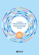
To assess national-level responses to NCDs, WHO has implemented NCD country capacity surveys periodically since 2001. This report is the latest in that series. Since the first survey round, the NCD Country Capacity
...
Survey (NCD CCS) has been conducted a further seven times, most recently in 2021. In the survey, completed by the NCD focal point within each country’s ministry of health or similar agency, countries are asked to report on the following topics relating to NCDs: (i) public health infrastructure, partnerships and multisectoral collaboration; (ii) policies, strategies and action plans; (iii) health information systems and surveillance; (iv) health system capacity for detection, treatment and care; and, added for 2021, (v) the impact of the COVID-19 pandemic on NCD-related resources and activities. The questionnaire is web-based and requires supporting documentation wherever possible. In the 2021 round, data were collected from May onwards, with the last survey responses arriving in September. Validation was carried out by WHO regional offices and WHO headquarters. Country responses to previous rounds of the survey were incorporated into the analysis to assess progress since 2010. Although all 194 Member States responded to the survey, data comparisons were restricted to the 160 countries that had responded to all rounds of the survey since 2010.
more
BMC Public Health, Volume 18, Article number: 303 (2018)
https://doi.org/10.1186/s12889-018-5208-0
Published: 02 March 2018
The "Assessing National Capacity for the Prevention and Control of Noncommunicable Diseases: Report of the 2021 Global Survey" by WHO examines the global state of readiness and infrastructure for managing noncommunicable diseases (NCDs) across count
...
ries. Based on the 2021 survey, it analyzes national capabilities in public health infrastructure, policies, health systems, and the impact of the COVID-19 pandemic on NCD-related resources. The report highlights gaps and strengths in NCD prevention, treatment, and health policy integration, offering insights for improving NCD care worldwide. It emphasizes the need for multisectoral collaboration and targeted actions to meet global health goals.
more
This report reviews the current situation in relation to national capacity to address NCDs and the progress made at country level over the past decade. It highlights that, while progress is being made, there is still much work to be done to create the infrastructure, policies, surveillance and healt
...
h systems response that will allow NCDs and their contributing risk factors to be successfully contained and reversed.
more

Male Circumcision and HIV in Lesotho: Is the Relationship Real or Spurious? Analysis of the 2009 Demographic and Health Survey
Makatjane, T. J., T. Hlabana, and E. M. Letete
Rockville, Maryland, USA: ICF International
(2016)
C2
DHS Working Papers No. 125

Maternal Child Nutrition. 2017;e12478
This paper analyzes individual level and household level determinants of anemia among children and women in Nepal and Pakistan. Applying multivariate modified Poisson models to recent national survey data, ... we find that the prevalence of anemia was significantly higher among women from the poorest households in Pakistan (adjusted prevalence ratio [95% CI]: 1.10 [1.04–1.17]), women lacking sanitation facilities in Nepal (1.22 [1.12–1.33]), and among undernourished women (BMI < 18.5 kg/m2) in both countries (Nepal: 1.10 [1.00–1.21] and Pakistan: 1.07 [1.02–1.13]). Similarly, children in both countries were more likely to be anemic if stunted (Nepal: 1.19 [1.09–1.30] and Pakistan: 1.10 [1.07–1.14]) and having an anemic mother (Nepal: 1.31 [1.20–1.42] and Pakistan: 1.21 [1.17–1.26]).
https://doi.org/10.1111/mcn.12478 more
DHS Working Paper No. 136
A total of 1,222 children age 6-23 months were included in this analysis. Twenty percent of children were stunted and 43% were moderately anemic. Regarding IYCF practices, only 16% of children received a minimum acceptable diet, 25% received diverse food groups, 58% were ... fed with minimum meal frequency, 85% currently breastfed, and 59% consumed iron-rich foods. Breastfeeding reduced the odds of being stunted. By background characteristics, male sex, perceived small birth size, children of short stature, and children of working mother were significant predictors of stunting. Iron-rich food consumption was inversely associated with moderate anemia. Among covariates, male sex and maternal anemia were also significant predictors of moderate anemia among children age 6-23 months.
The study concluded that stunting and anemia among young children in Myanmar are major public health challenges that need urgent action. more

Improving the quality of hospital antibiotic use is a major goal of WHO’s global action plan to combat antimicrobial resistance. The WHO Essential Medicines List Access, Watch, and Reserve (AWaRe) classification could facilitate simple stewardship interventions that are widely applicable globally.
...
We aimed to present data on patterns of paediatric AWaRe antibiotic use that could be used for local and national stewardship interventions.
www.thelancet.com/lancetgh Vol 7 July 2019
more

The WHO global health sector strategy on sexually
transmitted infections, 2016–2021 (1) includes country
milestones for achievement by 2020 and global
targets for achievement by 2030. In addition, countries
were called to identify national sexually transmitted
infection (STI) targets for
...
2020 and beyond. Reporting
on these milestones, country targets and progress on
implementation at the country level is due as a report to
the World Health Assembly in 2021 (1)
more

Climate change has important implications for the health and futures of children and young people, yet they have little power to limit its harm, making them vulnerable to climate anxiety. This is the first large-scale investigation of climate anxiety in children and young people globally and its rel
...
ationship with perceived government response.
more
Men are underrepresented in HIV testing services throughout sub-Saharan Africa. HIV testing is critical to achieve the UNAIDS 95-95-95 goals, as it is the first entry point to HIV care. In Malawi, an estimated 14% of HIV positive men are undiagnosed, while only 6% of HIV positive women remain undiag
...
nosed. Improved HIV testing among men is key to reaching UNAIDS goals, and to curbing HIV epidemics in the region.
more
Every day in 2020, approximately 800 women died from preventable causes related to pregnancy and childbirth - meaning that a woman dies around every two minutes.
Sustainable Development Goal (SDG) target 3.1 is to reduce maternal mortality to less than 70 maternal deaths per 100 000 live births by
...
2030.
The United Nations Maternal Mortality Estimation Inter-Agency Group (MMEIG) – comprising WHO, the United Nations Children’s Fund (UNICEF), the United Nations Population Fund (UNFPA), the World Bank Group and the United Nations Department of Economic and Social Affairs, Population Division (UNDESA/Population Division) has collaborated with external technical experts on a new round of estimates covering 2000 to 2020. The estimates represent the most up to date, internationally-comparable MMEIG estimates of maternal mortality, using refined input data and methods from previous rounds.
The report presents internationally comparable global, regional and country-level estimates and trends for maternal mortality between 2000 and 2020.
more
Evidence- and rights-based national policies, guidelines and legislation play a key role in improving sexual, reproductive, maternal, newborn, child and adolescent health (SRMNCAH), framing the enabling environment for equitable provision and accessibility of quality services. The SRMNCAH policy
...
survey monitors the existence of national SRMNCAH laws, policies, strategies and guidelines and the extent to which they are aligned with WHO recommendations on SRMNCAH. This publication reports on the findings from the 2023 WHO SRMNCAH policy survey.
more
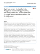
Rapid assessment of disability in the Philippines: understanding prevalence, well-being, and access to the community for people with disabilities to inform the W-DARE project
Manjula Marella, Alexandra Devine, Graeme Ferdinand Armecin et al.
Population Health Metrics
(2016)
CC
BioMed Central DOI 10.1186/s12963-016-0096-y
A policy brief highlighting key factors associated with adolescent pregnancy. Adolescent pregnancy undermines girls’ human rights and reduces opportunities to realize their full potential.
A policy brief on child marriage in Zambia. Child marriage is a human rights violation, and endangers young people' personal development and well-being; thus reducing opportunities to realize their full potential. Protecting girls from child marriage is a national priority and key towards sustainabl
...
e development.
more
What Motivates Women to Act? Perspectives on the Value of and Experiences in Using Antenatal Care in Khulna and Rangpur, Bangladesh
Nahar, Quamrun, Marzia Sultana, Kerry L. D. MacQuarrie, and Rasheda Khan
National Institute of Population Research and Training (NIPORT), International Center for Diarrhoeal Disease Research, Bangladesh (icddr,b), and ICF International
(2016)
C1
DHS Further Analysis Reports No. 100
Violence Against Women and HIV/AIDS Prevention and Treatment
Kenya Signature Programme Endline Evaluation Report: Bungoma, Busia and WajirCounties.
Obare F., Abuya T., Mukisa S., Odwe G., Kanyuuru L., Cassar C., Mohamed H.
Population Council and Save the Children
(2018)
CC
Lessons from a decade of Progress
Further analysis of the 1996, 2001, and 2006 Demographic and Health Surveys Data
Policy Brief | April 2015 | This brief accompanies the data sheet, Addressing Risk Factors for Noncommunicable Diseases Among Young People in Africa: Key to Prevention and Sustainable Development, and its data appendix, which provide all available country-specific data on four key NCD risk factors a
...
mong young people in Africa since 2004. These publications extend an earlier publication, Noncommunicable Disease Risk Factors Among Young People in Africa: Data Availability and Sources. All are available at www.prb.org/Publications/Datasheets/2015/ncd-risk-youth-africa.aspx.
more
The Men Are Away: Pregnancy Risk and Family Planning Needs among Women with a Migrant Husband in Barisal, Bangladesh
Khan, Rasheda, Kerry L. D. MacQuarrie, Quamrun Nahar, and Marzia Sultana
National Institute of Population Research and Training (NIPORT), International Center for Diarrhoeal Disease Research, Bangladesh (icddr,b), and ICF International
(2016)
C1
DHS Further Analysis Reports No. 98
Contraception and Family Planning, Preventing Unsafe Abortion and Accessing Postabortion Care, and Maternal Health
Comprehensive Sexuality Education and Adolescents Sexual and Reproductive Health
Policy Brief, Updated in March 2017
Key messages
• Sex workers have the right to equal protection under the law, regardless of the legal status of sex work.
• Sex workers have the right to access HIV, sexually transmitted infection (STI) and other health services free from the thr ... eat of violence, intimidation, incarceration, and stigma and discrimination.
• Justice and law enforcement sectors, together with the health sector and sex worker communities, should work in partnership to reform relevant legislation, policies and practices.
• Capacity development of all partners is critical to the success of the HIV response among sex workers. more
Trends and determinants of neonatal mortality in Nepal
Paudel, D., A. Thapa, P. R. Shedain, and B. Paudel
Nepal Ministry of Health and Population, New ERA, and ICF International
(2013)
C2
Further analysis of the Nepal Demographic and Health Surveys, 2001-2011
"Shadow" Report - Healthcare Field - Case of Albania
Albanian Center for Population and Development (ACPD); UNFPA
(2016)
C2
Submitted to the United Nation's Committee on the Convention on the Elimination
of All Forms of Discrimination Against Women
February 2016
Published by the Albanian Center for Population and Development (ACPD) Adresa : Bul “ Gjergj Fishta�
...
�, Kompleksi “Tirana 2000” Kulla 4, kati 2, Tiranë Web: www.acpd.al.org
more