Filter
2663
Text search:
mapping
Featured
224
827
Language
Document type
1442
494
293
167
150
38
32
27
8
5
3
1
1
Countries
139
103
86
72
68
64
59
57
57
53
53
49
47
46
45
41
39
30
30
30
29
29
29
29
23
23
21
20
19
19
19
18
17
17
17
17
16
15
15
14
14
13
13
13
13
12
12
12
11
10
10
9
9
9
9
8
8
7
7
7
6
5
5
5
5
5
5
5
4
4
4
4
4
3
3
3
3
3
3
3
3
3
3
3
3
3
3
3
3
2
2
2
2
2
2
2
2
2
2
2
2
2
2
2
2
2
2
2
2
2
1
1
1
1
1
1
1
1
1
1
1
1
1
1
1
1
1
1
1
1
1
1
1
1
Authors & Publishers
Publication Years
Category
1035
179
152
120
107
44
11
3
1
Toolboxes
212
150
148
140
123
115
101
99
82
78
68
65
64
56
49
29
26
23
23
22
19
11
6
2
1
1
The education sector forms an important part of the child protection response in refugee settings, and UNHCR’s Education Strategy (2012-16) reflects a focus on refugee education as a core component of UNHCR’s protection mandate. The right to education for all children also forms part of the Unit
...
Funded by CBM: www.cbm.org
A non-exhaustive reference list of organizations working with and for persons with disabilities world-wide.
THE RESEARCH FOUNDATION OF CEREBRAL PALSY ALLIANCE newsletter – NOVEMBER 2012

This factsheet describes the work and activities of the Center for Disease Control and Prevention (CDC) in Mozambique as well as its impact in this country.
Building Capacity for Disability Inclusion in Gender-Based Violence Programming in Humanitarian Settings, Tool. 7
Webinar.
The purpose of this booklet is to help readers understand why data on children with disabilities are currently inadequate, the difficulties that surround the gathering of high-quality data on disabled children, and why there is a real need to improve the collection, analysis, dissemination
...
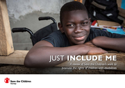
A review of Save the Children’s work to promote the rights of children with disabilities
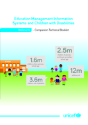
you can find all 14 Technical Booklets on Inclusive Education, produced by UNICEF, in ENGLISH. Other versions can be found on the website https://www.ded4inclusion.com/inclusive-education-resources-free/unicef-inclusive-education-booklets-and-webinars-english-version. Each Technical Booklet (and com
...
Final report 2016

The Third Rwandan Health Sector Strategic Plan (HSSP III) provides strategic guidance to the health sector for six years, between July 2012 and June 2018. HSSP III has been inspired and guided by the VISION 2020, which will make Rwanda a lower-middle-income country by 2020; the Rwandan Health Policy
...
Regional Network for Equity in Health in east and southern Africa (EQUINET): Disussion Paper 112
The Essential Health Benefit (EHB) is known as Essential Health Care Package (EHCP) in Swaziland. This desk review provides evidence on the experience of EHCPs in Swaziland and includes available po ...
The Essential Health Benefit (EHB) is known as Essential Health Care Package (EHCP) in Swaziland. This desk review provides evidence on the experience of EHCPs in Swaziland and includes available po ...
The State of the World's Midwifery
This report is primarily intended for the community of policymakers and researchers concerned about the rising risks of domestic, regional, and global infectious disease epidemics, and the collective failure to take the coordinated actions required to reduce such risks. These risks include the expec
...
Emergency response framework, 2nd ed.
recommended
The purpose of this Emergency Response Framework (ERF) is to clarify WHO’s roles and responsibilities in this regard and to provide a common approach for its work in emergencies. Ultimately, the ERF requires WHO to act with urgency and predictability to best serve and be accountable to populations
...
Inclusive Project Cycle Management
Inclusive Project Cycle Management

This study explored family adjustment and access to rehabilitative services for children with Down syndrome, between 0-5 years of age, in the ecoculture of Petchaburi Province, Thailand.
Estimating the size of key affected populations (KAP) provides important data for planning and implementing an effective response to the HIV epidemic. In the Philippines, these KAP include males who have sex with males (MSM), female sex workers (FSW), and injecting drug users (IDU). Given the diffic
...
This publication provides guidance to governments, civil society organizations (nongovernmental organizations and community-based organizations) and other partners implementing HIV prevention, care and treatment programs with key populations. This guide is designed to assist these programs in the de
...

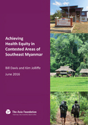
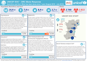
In many of Myanmar’s contested regions, healthcare services are provided through two parallel governance systems – by the government’s Ministry of Health, and by providers linked to ethnic armed organizations. Building upon efforts to build trust between these two actors following ceasefires s
...
Lack of satisfactory progress in mainstreaming disaster risk reduction within development is attributed to various factors. One of the important factor that is often not much appreciated is the inadequate comprehension of mainstreaming and the absence of clear, cogent and practical guidelines, tools
...

The study analyses the current situation of children with disabilities in relation to realizing their rights and accessing basic services, as well as their life experiences in their communities. It also focuses on identifying the barriers created by society that prevent children with disabilities fr
...
The document presents briefly Mozambique's profile on neglected tropical diseases, as well as recommendations on how to control them.
No publication year indicated.
The main goal of the National Health Plan (NHP) 2017-2021 is to extend access to a basic Essential Package of Health Services (EPHS) to the entire population while increasing financial protection. In order to extend service delivery to all communities, the NHP calls for all health workers (whether c
...
Accessed August 2018
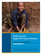
This manual is intended to enable WASH practitioners
who work in Mozambique to contribute to the
reduction of WASH-preventable NTDs.
Surveys are needed to guide trachoma control efforts in Mozambique, with WHO guidelines for intervention based on the prevalence of trachomatous inflammation–follicular (TF) in children aged 1–9 years and the prevalence of trichiasis in adults aged 15 years and above. We conducted surveys to com
...
This brief focuses specifically on the Grand Nord (Great North): the Beni and Lubero territories of northern North Kivu that are the epicentre of the outbreak. Further participatory enquiry should be undertaken with the affected populations, but given ongoing transmission, conveying key consideratio
...
PLoS ONE 13(8): e0202499. https://doi.org/10.1371/journal.pone.0202499
This was a school-based cross-sectional study conducted in 2015 among 305 school children aged 7–16 years from two primary schools located in Ilemela and Magu Districts, north-western Tanzania. Single stool and urine samples w
...
September Highlights
Ebola prevention measures began in South Sudan with three border screening points established
Nearly 160,000 people reached with WASH services throughout South Sudan
This companion to the ALNAP EHA Guide offers protection-specific insights for evaluators and evaluation commissioners across the humanitarian sector. It covers the planning, data management and analysis phases of evaluation and addresses a range of challenges that – whilst not all unique to protec
...
Living Conditions Among Persons with Disability Survey Report
This analytical report reviews and discusses the potential role and influence of political commitment in implementing endorsements and conducting policy in the field of tuberculosis (TB) prevention and care. It promotes discussion by comparing and analysing the extent to which selected international
...
A WHO-ITU Standard.
Nearly 50% of people aged 12-35 years – or 1.1 billion young people – are at risk of hearing loss due to prolonged and excessive exposure to loud sounds, including music they listen to through personal audio devices. Ahead of World Hearing Day (3 March), the World Health Org
...
Is the first appendix for the Psychological First Aid Field for Schools (PFA-S) Operations Guide. This appendix provides recommendations for school staff (including principals and administrators, teachers, health-related professionals, and support staff) on providing Psychological First Aid at a sch
...
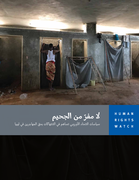
This report documents severe overcrowding, unsanitary conditions, malnutrition, and lack of adequate health care. Human Rights Watch found violent abuse by guards in four official detention centers in western Libya, including beatings and whippings. Human Rights Watch witnessed large numbers of chil
...
Communities can play a critical role in suicide prevention. Facilitating community engagement in suicide prevention is an important task. The toolkit is a step-by-step guide for communities to engage in suicide prevention activities and have ownership of the process and keep efforts sustained. It is
...
An output of a series of workshops on psychosocial support held in 2004-2005 by the Bernard van Leer Foundation and the Coalition on Children Affected by AIDS. Authors Linda Richter, Geoff Foster and Lorraine Sherr discuss the issues surrounding psychosocial care and support for children made vulner
...
This compendium collates current tools and resources on quality improvement developed by the WHO Service Delivery and Safety Department and provides examples of how the tools and resources have been applied in country settings. The target audience for this document are ministries of health, facility
...
Much remains unknown about displaced communities in out-of-camp areas as identification constraints hinder knowledge on the overall situation and preeminent needs of an area. When compared to regularly monitored in-camp populations, less is known about the health, sanitation, livelihoods, food secur
...
Children's Health and the Environment WHO Training Package for the Health Sector World Health Organization
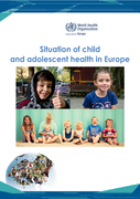
The report focuses on several key areas where health outcomes are falling short, and provides insight into ways in which countries can improve the situation for their children and adolescents. Areas in focus include mental health, overweight/obesity and adolescent risk-taking behaviour.
The report
...
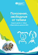
В настоящем докладе освещены текущие и вновь появляющиеся проблемы, связанные с воздействием табака на здоровье детей в Регионе, а также рассмотрены нормативно-пр
...
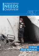
The figures and findings reflected in the 2019 Humanitarian Needs Overview (HNO) represent the independent analysis
of the United Nations (UN) and its humanitarian partners based on information available to them. While the HNO aims
to provide consolidated humanitarian analysis and data to help inf
...
Инструмент Всемирной Организации Здравоохранения для Оценки Систем Психического Здоровья
(ИОСПЗ-ВОЗ) представляет собой новый инструмент, предназначенный для с�
...
Suicides take a high toll. Over 800 000 people die by suicide every year and it is the second leading cause of
death in 15-29-year-olds. Most suicides occur in low- and middle-income countries where resources
and services, if they do exist, are often scarce and limited for early identification, tr
...
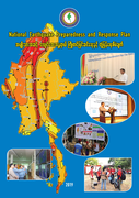
It aims to minimize damage to property, reduce injury and lives lost, and normalize the lives of those affected in a timely manner in the case of a damaging earthquake in the country.
It also seeks to contribute to the achievements of Myanmar Sustainable Development Goals as well as respond to Gl
...
During the past five decades, the incidence of dengue has increased 30-fold. Some 50–100 million new infections are estimated to occur annually in more than 100 endemic countries, with a documented further spread to previously unaffected areas; every year hundreds of thousands of severe cases ari
...
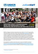
UNHCR is committed to strengthening programming to prevent, mitigate and respond to sexual and genderbased violence (SGBV) in all operations. In 2018, through funding from Safe from the Start, UNHCR launched a mainstreaming project with the specific objective of supporting UNHCR’s institutionalisa
...
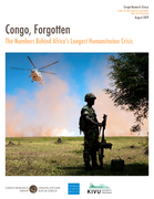
This report used the results of the Tracker’s first two years to examine the general trends of conflict in North and South Kivu, the main factors contributing to the violence, and the broader challenges for peacekeeping efforts.
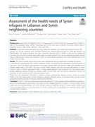
Health needs of displaced Syrians in refugee hosting countries have become increasingly complex in light of the protracted Syrian conflict. The primary aim of this study was to identify the primary health needs of displaced Syrians in Iraq, Jordan, Lebanon, Turkey, and Syria.
Настоящие руководящие принципы предназначены для специалистов, имеющих дело с теми потребителями наркотиков, которые применяют наиболее проблемные модели потре�
...
International Journal of Infectious Diseases 46 (2016) 56–60
Child Survival Working Group
Accessed: 18.10.2019
نظام مغشوش
سياسات الحكومة السورية لاستغلال المساعدات الإنسانية وتمويل إعادة الإعمار
Many low-resource settings have a shortage of physicians and health workers. (1) In order to provide patient-centred continuous care more effectively, primary care systems can include team-based care strategies in their clinic workflows and protocols. Team-based care uses multidisciplinary teams (wh
...
Practical Guidance for collaborative interventions
16 January 2008
Global Health Advocacy and Activism Department of Global Health, George Washington University
11/6/08 2:36:52 PM
st_ma_media.indd
www.raisingvoices.org/sasa.php
Accessed: 17.11.2019
Overwhelming evidence shows that a range of health concerns—mental illness, substance dependence, HIV/AIDS, and noncommunicable diseases—affect prisoners disproportionately. But, while incarceration poses risks to health—including inadequate nutrition and exposure to violence—prisons also pr
...
Recommendations, resources and references
A publication of the Southern African HIV Clinicians Society
African Evaluation Journal
ISSN: (Online) 2306-5133, (Print) 2310-4988
Background: For some years, non-governmental organisations (NGOs) and civil society have
become increasingly involved in the fight against the HIV/AIDS pandemic in Africa. But even
though their role is well appreciated, the
...
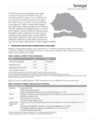
In 2016, Senegal made a minimal advancement in efforts to eliminate the worst forms of child labor. In June, the Government launched an initiative to remove tailbés from the street and prosecute marabouts that perpetrate crimes against their students; however, no marabouts were prosecuted during th
...
Antimicrobial resistance (AMR) is a threat to human and animal health and refers to the ability of microorganisms to defy the medicines prescribed. For instance when antibiotics are used improperly, such as an incorrect dose, insufficient duration or wrong frequency, resistance is heightened. The mi
...
As the number of transboundary pest and animal and foodborne disease outbreaks rises, so does the number of people who are chronically hungry due to these and other factors. The correlation can be explained by the link between our health and that of the planet. We rely on land and sea for the produc
...
Accessed: 24.03.2020
Antimicrobial resistance (AMR) has become a global public health concern and Lebanon is of no exception to this issue. The spread of antimicrobial-resistant bacteria is considered an alarming public health threat, with a potential extent similar to global warming and other social and environmental t
...
Antibiotics have been useful in fighting infectious diseases in our country for decades, but because of the overuse and misuse of these agents, an increasing number of organisms are now resistant to them. The Philippines, like other Southeast Asian countries, has already been encountering the many c
...
A practical approach for developing policy and strategy to improve quality of care
The handbook outlines an approach for the development of national policies and strategies to improve the quality of care. Such policy and strategy can help clarify the structures, roles and responsibilities within n
...
Version dated April 1st, 2020.
The flow of migrants and refugees from Venezuela constitutes the largest mobilization of people in the history of Latin America. By March 2020, more than 4.9 million Venezuelans have left their country and from these, more than 4.1 million have been mobilized to count
...
Thematic Report– 3 April 2020
ACAPS Risk Analysis: COVID19
info@acaps.org
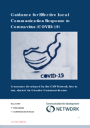
The guide seeks to address questions about how we can face local communication challenges presented by the pandemic, and how communicators respond effectively to the situation through supporting our communities to cope and to protect themselves. This guide aims to provide insights for a wide range o
...