Filter
2057
Text search:
disasters
Featured
201
546
Language
Document type
1184
357
148
139
101
42
40
31
9
2
2
1
1
Countries
111
99
58
43
38
34
34
33
33
32
30
28
27
24
22
22
21
20
19
18
18
17
17
17
16
16
15
14
14
13
12
11
11
10
10
10
9
9
9
8
8
8
7
7
7
7
7
6
6
6
6
5
5
5
5
4
4
4
4
4
4
4
3
3
3
3
3
3
3
3
3
3
2
2
2
2
2
2
2
2
2
2
2
2
2
2
2
2
2
2
2
1
1
1
1
1
1
1
1
1
1
1
1
1
1
1
1
1
1
1
1
1
1
Authors & Publishers
Publication Years
Category
620
183
111
95
63
39
11
4
3
1
Toolboxes
204
191
171
136
136
121
90
83
72
50
48
41
29
24
23
21
20
13
9
8
6
5
5
3
2
1
This document provides information for WHO Member States, particularly low-income and middle-income countries, to strengthen preparedness and response plans with regard to the social and mental health consequences of biological and chemical attacks.
The message contained in this publication is clear: countries need a
public health system that can respond to the deliberate release of
chemical and biological agents. Regrettable though this message may
be, the use of poison gas in the war between Iraq and the Islamic
Republic of Iran in the 19
...
IDS Rapid Response Briefing 8
An all-hazards tool for hospital administrators and emergency managers.
The World Health Organization Regional Office for Europe has developed the Hospital emergency response checklist to assist hospital administrators and emergency managers in responding effectively to the most likely disaster sce
...
Disaster Preparedness Training Programme
TB policies in 29 Countries
A survey of prevention, testing and treatment policies and practices
A survey of prevention, testing and treatment policies and practices
The ERP approach seeks to improve effectiveness by reducing both time and effort, enhancing predictability through establishing predefined roles, responsibilities and coordination mechanisms. The Emergency Response Preparedness Plan (ERPP) has four main components: i) Risk Assessment, ii) Minimum Pr
...
The need for a roadmap for risk assessment stemmed from the lack of standardised and systematic effort to national risk assessment effort to date. The road map details the process, activities necessary for each step and the availability and accessibility of technical and financial resources, and coo
...
The BRACED Myanmar Alliance was a three-year project aiming to ‘build the resilience of 350,000 people across Myanmar to climate extremes’. The project worked in 7 states, 8 townships and 155 communities. The main impact for project populations was intended to be ‘improved well-being and reduc
...
EVALUATION REPORT | This evaluation is the first comprehensive global exercise to examine UNICEF’s programme response in protecting children in emergencies. Its purpose is to strengthen child protection programming by assessing performance in recent years and to draw lessons and recommendations th
...
In December 2013, UNICEF published its first comprehensive evaluation assessing how well its global and country strategies and programmes have worked to protect children in emergencies.
The ‘Evaluation of UNICEF Programmes to Protect Children in Emergencies’ was undertaken to identify key suc
...
AACAP OFFICIAL ACTION | This Practice Parameter identifies best approaches to the assessment and management of children and adolescents across all phases of a disaster. Delivered within a disaster system of care, many interventions are appropriate for implementation in the weeks and months after a d
...
Pschyologische Erste Hilfe. Handbuch
recommended
Diese Publikation wurde im 2011 unter dem Titel „Psychological first aid: Guide for field
workers“ von der Weltgesundheitsorganisation (WHO) herausgegeben.
Compared to the previous five-year assessment period 2011–2015, the current five-year period 2015–2019 has seen a continued increase in carbon dioxide (CO2 ) emissions and an accelerated increase in the atmospheric concentration of major greenhouse gases (GHGs), with growth rates nearly 20% high
...
This Guide provides practical guidance for governments regarding how to effectively communicate with communities during the recovery phase following an emergency. It explains how to identify communication needs, and presents “best fit” communication methods and strategies to deploy to support Di
...

The Gap Report 2014
3rd Edition – July 2017
www.msfaccess.org
Accessed: 26.02.2020
Volunteers are impacted by COVID-19 like everyone else worldwide. They worry about being stigmatized by family and community members, fear contracting the virus, having to be in isolation or quarantine, losing colleagues etc. Volunteers may also be affected by witnessing the death of someone they su
...
A brief guide for those using social media in humanitarian organizations
Experiences and recommendations from the International Red Cross and Red Crescent Movement.
Measures imposed by governments to prevent the spread of the disease, including lockdown restrictions, quarantines, physical distancing, and their economic and social consequences, further increase this dist
...
A new report from aid agencies Age International and HelpAge International, If not now, when? criticises the humanitarian sector for its failure to address the needs of older people in emergencies. This failure contravenes several international commitments made in recent years and flies in the face
...
his document, a first of its kind, clearly sets out the standards for rehabilitation and provides guidance on building or strengthening the capacity of EMTs in this area.The importance of early rehabilitation for functional outcomes is well documented. Rehabilitation needs can pe
...
Medizinisches Notfall Teams: Technische Mindestanforderungen und Empfehlungen für die Rehabilitation
Rehabilitation wird zunehmend als notwendiger Aspekt der medizinischen Hilfe und patientenorientierten Versorgung anerkannt, wie ihre Aufnahme in die Klassifikation und Mindeststandards für ausländischen medizinischen Teams bei plötzlich auftreten
...
his document, a first of its kind, clearly sets out the standards for rehabilitation and provides guidance on building or strengthening the capacity of EMTs in this area.The importance of early rehabilitation for functional outcomes is well documented. Rehabilitation needs can pe
...
This document, a first of its kind, clearly sets out the standards for rehabilitation and provides guidance on building or strengthening the capacity of EMTs in this area.The importance of early rehabilitation for functional outcomes is well documented. Rehabilitation needs can p
...
The Sendai Framework for Disaster Risk Reduction highlights children as among the most vulnerable groups who must be empowered to get ready for natural hazards and play a vital role in preventing and reducing risk.
This child-friendly booklet is for kids who are 6-12 years old to generate earthqu
...
Earthquake Haiti: Guidelines and Resources
recommended
25 August 2021. The earthquake on August 14, 2021 was almost as strong as the severe quake in 2010, which killed about 300,000 people. The current number of victims is more than 2,200 people, and more than 12,000 people have been injured. More than 52,000 houses were destroyed and more than 77,000
...
The Lancet Published Online September 13, 2016 http://dx.doi.org/10.1016/S0140-6736(16)31404-0
This Strategic Operating Framework (SOF) has been developed to guide WASH Sector partners in responding to humanitarian needs in Sudan in conjunction with the existing and forthcoming humanitarian response plans (2022 and 2023). This SOF is drafted in consultation with the Strategic Advisory Group (
...
For the estimated 20 million refugees and 25 million internally displaced people worldwide, well-planned settlements can help to maximise their protection and security, and support them to minimise the spread of disease, manage natural resources sustainably, and maintain good relations with their ho
...

Decision-making for preparedness and response
Specific action sheets offer useful guidance on mental health and psychosocial support and cover the following areas coordination assessment monitoring and evaluation protection and human rights standards human resources community mobilisation and support health services education dissemination of i
...
Mental and Social Aspects of Health of Populations Exposed to Extreme Stressors
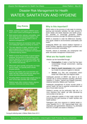
excreta disposal in emergencies

Technical Aspects Part II
For emergency relief staff


Guidelines for WHO Representatives and Country
Offices in the Western Pacific Region
Emergency Capacitiy Building Project agencies, led by CARE, have developed the Shelter Accountability Resources for project managers and decision-makers in humanitarian shelter programs.
As a guide it is also intended to be useful for Shelter Cluster coordinators, and other staff who would like t
...
The report offers an overview of the progress the humanitarian sector has made and the obstacles it has faced over the past 10 years. Accountability is no longer just a fashionable term, there is now a shared understanding of what it takes to be accountable. From changes at policy level, to concrete
...
These Guidelines comprise a General Guidelines document that provides the basic parameters of DG ECHO humanitarian health assistance, complemented by specific Technical Guidance in annex.
Esta publicación hace eco de la obra titulada Administración sanitaria de emergencia
con posterioridad a los desastres naturales (Publicación Científica No. 407) editada en
1981, pero es un libro totalmente nuevo, de organización reciente y con mucho material original. Esboza la función que
...

Core Knowledge for Emergency Preparedness and Response
The Guide has been developed to enhance the knowledge capabilities of NDMAs and their local partners. This is accomplished by exposing them to the existing tools and services developed by the international community to facilitate effective disaster response to any scale of disaster (small, medium an
...
PLoS Curr. 2014 Aug 29;6. pii: ecurrents.dis.17ad1f98fb85be80785d0a81ced6a7a6. doi: 10.1371/currents.dis.17ad1f98fb85be80785d0a81ced6a7a6.

The report provides an overview of the disaster risk reduction and management in Nepal, a country under threat of multiple natural hazards: earthquakes, floods, landslides, fires, storms, the epidemics, and others. It presents background information on the country, its disaster profile, its legal an
...
A field manual for Red Cross/Red Crescent personnel and volunteers

Die Bundespsychotherapeutenkammer (BPtK) möchte mit diesem Standpunkt über die psychischen Belastungen und Erkrankungen bei Flüchtlingen informieren, auf die Problemfelder und Handlungsbedarfe bei der Gesundheitsversorgung psychisch erkrankter Flüchtlinge aufmerksam machen und Möglich
...
The Handbook on Law and Disaster Risk Reduction (the Handbook) has been developed to provide guidance on how to use the Checklist and conduct related legislative reviews and reform processes. While the methodology for using the Checklist needs to be tailored to each country’s context and respectiv
...

Conducting simulations and drills is the most effective way to evaluate and test disaster preparedness plans; these exercises are used widely by organizations and institutions working in development and in disaster response. Drills and simulations are also excellent tools for training, and for asses
...
This guidance highlights tangible, evidence-based priority actions in health and WASH programs to achieve the Global Targets for nutrition. Throughout the guidance the importance of cross-sectoral collaboration within and outside the Red Cross Red Crescent Movement to holistically address nutrition
...
Reference book specifying the principles of intervention for all food security activities, from initial assessment to programme implementation.
Integrating WASH and MHCP interventions will always require imagination and creativity to adapt the approach to specific conditions, opportunities and constraints in each context. The book is designed to stimulate reflection and encourage initiatives to seek opportunities for closer integration of t
...
Conceived as part of the CWS-A/P project on regional security and risk management, this book presents a
collection of testimonies from aid workers in some of the most insecure and volatile environments in the world.
The participants recount a broad array of security incidents, such as kidnappings,
...

Rapid Assessment Guide for Psychosocial Support and Violence Prevention in Emergencies and Recovery
recommended
This guide provides standards and directions on how to carry out rapid needs assessment for Psychosocial Support (PSS) and Violence Prevention (VP) initiatives including child protection and sexual and gender-based violence. In particular, this rapid assessment tool is designed to help gather data i
...

Where There Is No Doctor. New Chapters
recommended
Advance chapters from the new edition
The guide is divided into 3 sections —the first focuses on the conceptual framework for M&E; the second focuses on six key steps for M&E; and further, the appendix provides additional tools, resources, and projects for M&E. With a comprehensive breakdown of the important approaches as well as a ch
...
This reference manual provides in-depth knowledge on the techniques, methodologies and best practices for using geospatial information in support of decision making for disaster risk management for specific hazards