Filter
3249
Text search:
maps
Featured
353
806
Language
Document type
1581
686
426
227
139
79
37
26
16
12
10
3
2
Countries
180
85
62
60
57
55
53
51
50
48
47
46
44
41
36
36
34
29
28
27
26
25
25
24
24
24
21
21
20
20
19
18
17
16
15
15
15
13
13
12
12
11
11
11
10
10
9
9
8
8
8
7
7
7
7
6
6
6
6
6
6
6
5
5
5
5
5
4
4
4
4
4
4
4
4
3
3
3
3
3
3
3
3
3
3
3
3
3
3
3
3
3
2
2
2
2
2
2
2
2
2
2
2
2
2
2
2
2
2
2
2
2
2
2
1
1
1
1
1
1
1
1
1
1
1
1
1
1
1
1
1
1
1
1
1
1
1
Authors & Publishers
Publication Years
Category
738
412
290
252
182
91
66
5
1
Toolboxes
225
206
206
197
185
185
146
110
108
107
101
96
82
68
60
54
52
43
32
27
24
23
3
2
2
A Global Campaign Against Epilepsy Demonstration Project
Interim policy guidance
4th edition. This is fourth edition of Treatment of tuberculosis: guidelines, adhering fully to the new WHO process for evidence-based guidelines. Several important recommendations are being promoted in this new edition
Snakebites are well-known medical emergencies in many parts of the world, especially in rural areas. Agricultural workers and children are the most affected. The incidence of snakebite mortality is particularly high in South-East Asia. Rational use of snake anti-venom can substantially reduce mortal
...

Kenya : Management of Severe Malaria
recommended
This Handbook, an updated edition of the Management of Severe Malaria, provides new and revised practical guidance on the diagnosis and management of severe malaria.
Case Management; Guide for Tutors
1.HIV infections – drug therapy. 2.Anti-HIV agents – adverse effects. 3.Anti-retroviral agents. 4.Benzoxazines – adverse effects. 5.Pregnancy. 6.Disease transmission, Vertical - prevention and control. 7.Treatment outcome. I.World Health Organization
New edition
A guide for field health workers
Buruli Ulcer Prevention of Disability (POD)
recommended
This manual is for use by doctors, nurses, rehabilitation specialists, National Buruli ulcer Control Programme managers and other health workers involved in the prevention of disability activities in Buruli ulcer.
The guide contains valuable tools for wound care and the rehabilitation of people affected by Buruli ulcer. It is also helpful for peripheral health centres in areas where Buruli ulcer is endemic and to people and their families affected by the disease

Guidelines for District Health Managers

Prevention Of Cardiovascular Disease: Guidelines For Assessment And Management Or Cardiocascular Risk
recommended
This publication provides guidance on reducing disability and premature deaths from coronary heart disease, cerebrovascular disease and peripheral vascular disease in people at high risk, who have not yet experienced a cardiovascular event.
Handbook; EmOC indicators
Education material for teachers of midwifery
Midwifery education modules - second edition
Education material for teachers of midwifery
Midwifery education modules - second edition
Education material for teachers of midwifery
Midwifery education modules - second edition
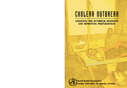
Cholera Outbreak Response
recommended
Document available in English, French, Russian, Spanish, Portuguese and Swahili. For other languages check also: http://www.who.int/cholera/publications/OutbreakAssessment/en/
The 2nd edition is publised in 2017.

Abbreviated Report of a WHO Consultation
The Atlas of health and climate is a product of this unique collaboration between the meteorological and public health communities. It provides sound scientific information on the connections between weather and climate and major health challenges. These range from diseases of poverty to emergencies
...
This Manual covers all important aspects of echinococcosis, including parasite biology and life-cycles, geographic distribution and prevalence, epidemiology, clinical presentation in humans and animals, diagnosis and treatment, as well as control and prevention using newly developed tools and method
...
Rreport of a WHO Consultative Meeting Kolkata India 2012
Sexual and Reproductive Health
Manual for Trainers and Programme Managers
Handbook For Clinical Management Of Dengue
recommended
Clinical management handbook
Bambo has Bilharzia (English version)
recommended
What Children Should Know About Bilharzia; Educational Comic. ACKNOWLEDGEMENT: This document was made possible through a financial grant from Merck, Germany. In 2007, Merck entered into a partnership with the World Health Organization (WHO) to combat schistosomiasis in school children on the African
...
Recognition Booklet For Communities
Recommendations on action and research for:
a) preventing early pregnancy
b) preventing poor reproductive outcomes
2nd edition. Essential guideline for humanitarian assistance
Evidence for technical update of pocket book recommendations. Newborn conditions, dysentery, pneumonia, oxygen use and delivery, common causes of fever, severe acute malnutrition and supportive care
A handbook for building skills, Updated 2013
WHO six-year strategy for the health sector and community capacity development.
A toolkit for behavioural and social communication in outbreak response
Best practices for communicating with the public during an outbreak
A handy desk reference tool for primary level health workers. The Adolescent Job Aid is a handy desk reference tool for health workers (trained and registered doctors, nurses and clinical officers) who provide services to children, adolescents and adults. It aims to help these health workers respond
...
This publication is an updated version of the Management of Tuberculosis and HIV Coinfection clinical protocol released in 2007 by the WHO Regional Office for Europe. It is intended for all health care workers involved in preventing, diagnosing, treating and caring for people living with TB and HIV
...
This guide is an attempt to redress the deficit in understanding of implementation research and to encourage programme personnel and implementers to take a greater interest in the subject, recognizing that implementation research is in fact an integral part of programme planning and execution, rathe
...
Male circumcision reduces a man’s risk of heterosexual acquisition of HIV by about 60%. This guideline provides an evidence-based recommendation on the use of adult male circumcision devices for HIV prevention in public health programmes in high HIV prevalence, resource-limited settings. It also p
...
Risk assessment and priority interventions
Disaster planning - organization and administration. 2.Emergency medical services - methods. 3.Emergency medical services - organization and administration. 4.Emergencies. 5.Health policy. 6.Health facilities.7.Guidelines.

Undernutrition increases the risk of tuberculosis (TB) and in turn TB can lead to malnutrition. Undernutrition is therefore highly prevalent among people with TB. It has been demonstrated that undernutrition is a risk factor for progression from TB infection to active TB disease and that undernutrit
...
Cervical intraepithelial neoplasia (CIN) is a premalignant lesion that may exist at any one of three stages: CIN1, CIN2, or CIN3. If left untreated, CIN2 or CIN3 (collectively referred to as CIN2+) can progress to cervical cancer. Instead of screening and diagnosis by the standard sequence of cytolo
...
A quick reference guide for health authorities and health-care workers
Revised 2015
The revised package of BFHI materials includes five sections: 1. Background and Implementation, 2. Strengthening and Sustaining the BFHI: A course for decision-makers, 3. Breastfeeding Promotion and Support in a Baby-friendly Hospital: a 20-hour course for maternity staff, 4. Hospital Self-Appraisal
...

Model Chapter for textbooks for medical students and allied health professionals
Volume 1 covers emergency triage assessment and treatment, and acute care for a severely ill or acutely injured patient for approximately the first 24 hours of care. It describes the clinical procedures commonly used in emergency and acute care, and gives a summary of the medicines used and the step
...
Guide for tutors
Report of a WHO technical consultation meeting
Ouagadougou, Burkina Faso


Programmatic update
April 2012
Executive Summary