Filter
3401
Text search:
map
Featured
262
1135
Language
3266
95
64
37
31
30
15
11
9
4
4
3
3
3
3
2
2
2
2
2
2
2
2
2
2
2
1
1
1
1
1
1
1
1
1
1
1
1
1
1
1
1
1
1
1
1
1
1
1
1
Document type
1959
619
272
163
163
59
43
33
30
30
27
3
Countries
164
125
108
104
103
93
76
76
75
74
73
72
69
66
56
56
50
48
47
47
46
45
40
39
38
37
36
34
34
32
28
27
26
25
24
24
23
23
20
19
19
17
15
15
15
15
15
14
13
12
12
11
11
10
10
9
9
8
8
8
8
8
7
7
7
7
7
6
6
6
6
5
5
5
5
5
5
4
4
4
4
4
4
3
3
3
3
3
3
3
3
3
3
3
3
2
2
2
2
2
2
2
2
2
2
2
2
2
2
2
2
2
2
2
2
1
1
1
1
1
1
1
1
1
1
1
1
1
1
1
1
1
1
1
1
1
1
1
Authors & Publishers
371
130
130
97
84
83
60
58
39
36
29
28
20
20
20
18
18
17
17
17
16
16
16
15
15
14
13
13
13
12
12
12
12
12
11
11
10
10
10
10
9
9
9
9
9
9
9
9
9
9
8
8
8
8
8
8
8
8
8
8
8
8
7
7
7
7
7
7
7
7
7
6
6
6
6
6
6
6
6
6
6
6
6
5
5
5
5
5
5
5
5
5
5
5
5
5
5
5
5
5
5
5
5
5
5
4
4
4
4
4
4
4
4
4
4
4
4
4
4
4
4
4
4
4
4
4
4
4
4
4
4
4
4
4
4
4
4
4
4
4
4
4
3
3
3
3
3
3
3
3
3
3
3
3
3
3
3
3
3
3
3
3
3
3
3
3
3
3
3
3
3
3
3
3
3
3
3
3
3
3
3
3
3
3
3
3
3
3
3
3
3
3
3
3
3
3
3
3
3
3
3
3
3
3
3
3
3
3
3
3
3
3
3
3
3
3
3
3
3
3
3
3
3
3
3
3
2
2
2
2
2
2
2
2
2
2
2
2
2
2
2
2
2
2
2
2
2
2
2
2
2
2
2
2
2
2
2
2
2
2
2
2
2
2
2
2
2
2
2
2
2
2
2
2
2
2
2
2
2
2
2
2
2
2
2
2
2
2
2
2
2
2
2
2
2
2
2
2
2
2
2
2
2
2
2
2
2
2
2
2
2
2
2
2
2
2
2
2
2
2
2
2
2
2
2
2
2
2
2
2
2
2
2
2
2
2
2
2
2
2
2
2
2
2
2
2
2
2
2
2
2
2
2
2
2
2
2
2
2
2
2
2
2
2
2
2
2
2
2
2
2
2
2
2
2
2
2
2
2
2
2
2
2
2
2
2
2
2
2
2
2
2
2
2
2
2
2
2
2
2
2
2
2
2
2
2
2
2
2
2
2
2
2
2
2
2
2
2
2
2
2
2
2
2
2
2
2
2
1
1
1
1
1
1
1
1
1
1
1
1
1
1
1
1
1
1
1
1
1
1
1
1
1
1
1
1
1
1
1
1
1
1
1
1
1
1
1
1
1
1
1
1
1
1
1
1
1
1
1
1
1
1
1
1
1
1
1
1
1
1
1
1
1
1
1
1
1
1
1
1
1
1
1
1
1
1
1
1
1
1
1
1
1
1
1
1
1
1
1
1
1
1
1
1
1
1
1
1
1
1
1
1
1
1
1
1
1
1
1
1
1
1
1
1
1
1
1
1
1
1
1
1
1
1
1
1
1
1
1
1
1
1
1
1
1
1
1
1
1
1
1
1
1
1
1
1
1
1
1
1
1
1
1
1
1
1
1
1
1
1
1
1
1
1
1
1
1
1
1
1
1
1
1
1
1
1
1
1
1
1
1
1
1
1
1
1
1
1
1
1
1
1
1
1
1
1
1
1
1
1
1
1
1
1
1
1
1
1
1
1
1
1
1
1
1
1
1
1
1
1
1
1
1
1
1
1
1
1
1
1
1
1
1
1
1
1
1
1
1
1
1
1
1
1
1
1
1
1
1
1
1
1
1
1
1
1
1
1
1
1
1
1
1
1
1
1
1
1
1
1
1
1
1
1
1
1
1
1
1
1
1
1
1
1
1
1
1
1
1
1
1
1
1
1
1
1
1
1
1
1
1
1
1
1
1
1
1
1
1
1
1
1
1
1
1
1
1
1
1
1
1
1
1
1
1
1
1
1
1
1
1
1
1
1
1
1
1
1
1
1
1
1
1
1
1
1
1
1
1
1
1
1
1
1
1
1
1
1
1
1
1
1
1
1
1
1
1
1
1
1
1
1
1
1
1
1
1
1
1
1
1
1
1
1
1
1
1
1
1
1
1
1
1
1
1
1
1
1
1
1
1
1
1
1
1
1
1
1
1
1
1
1
1
1
1
1
1
1
1
1
1
1
1
1
1
1
1
1
1
1
1
1
1
1
1
1
1
1
1
1
1
1
1
1
1
1
1
1
1
1
1
1
1
1
1
1
1
1
1
1
1
1
1
1
1
1
1
1
1
1
1
1
1
1
1
1
1
1
1
1
1
1
1
1
1
1
1
1
1
1
1
1
1
1
1
1
1
1
1
1
1
1
1
1
1
1
1
1
1
1
1
1
1
1
1
1
1
1
1
1
1
1
1
1
1
1
1
1
1
1
1
1
1
1
1
1
1
1
1
1
1
1
1
1
1
1
1
1
1
1
1
1
1
1
1
1
1
1
1
1
1
1
1
1
1
1
1
1
1
1
1
1
1
1
1
1
1
1
1
1
1
1
1
1
1
1
1
1
1
1
1
1
1
1
1
1
1
1
1
1
1
1
1
1
1
1
1
1
1
1
1
1
1
1
1
1
1
1
1
1
1
1
1
1
1
1
1
1
1
1
1
1
1
1
1
1
1
1
1
1
1
1
1
1
1
1
1
1
1
1
1
1
1
1
1
1
1
1
1
1
1
1
1
1
1
1
1
1
1
1
1
1
1
1
1
1
1
1
1
1
1
1
1
1
1
1
1
1
1
1
1
1
1
1
1
1
1
1
1
1
1
1
1
1
1
1
1
1
1
1
1
1
1
1
1
1
1
1
1
1
1
1
1
1
1
1
1
1
1
1
1
1
1
1
1
1
1
1
1
1
1
1
1
1
1
1
1
1
1
1
1
1
1
1
1
1
1
1
1
1
1
1
1
1
1
1
1
1
1
1
1
1
1
1
1
1
1
1
1
1
1
1
1
1
1
1
1
1
1
1
1
1
1
1
1
1
1
1
1
1
1
1
1
1
1
1
1
1
1
1
1
1
1
1
1
1
1
1
1
1
1
1
1
1
1
1
1
1
1
1
1
1
1
1
1
1
1
1
1
1
1
1
1
1
1
1
1
1
1
1
1
1
1
1
1
1
1
1
1
1
1
1
1
1
1
1
1
1
1
1
1
1
1
1
1
1
1
1
1
1
1
1
1
1
1
1
1
1
1
1
1
1
1
1
1
1
1
1
1
1
1
1
1
1
1
1
1
1
1
1
1
1
1
1
1
1
1
1
1
1
1
1
1
1
1
1
1
1
1
1
1
1
1
1
1
1
1
1
1
1
1
1
1
1
1
1
1
1
1
1
1
1
1
1
1
1
1
1
1
1
1
1
1
1
1
1
1
1
1
1
1
1
1
1
1
1
1
1
1
1
1
1
1
1
1
1
1
1
1
1
1
1
1
1
1
1
1
1
1
1
1
1
1
1
1
1
1
1
1
1
1
1
1
1
1
1
1
1
1
1
1
1
1
1
1
1
1
1
1
1
1
1
1
1
1
1
1
1
1
1
1
1
1
1
1
1
1
1
1
1
1
1
1
1
1
1
1
1
1
1
1
1
1
1
1
1
1
1
1
1
1
1
1
1
1
1
1
1
1
1
1
1
1
1
1
1
1
1
1
1
1
1
1
1
1
1
1
1
1
1
1
1
1
1
1
1
1
1
1
1
1
1
1
1
1
1
1
1
1
1
1
1
1
1
1
1
1
1
1
1
1
1
1
1
1
1
1
1
1
1
1
1
1
1
1
1
1
1
1
1
1
1
1
1
1
1
1
1
1
1
1
1
1
1
1
1
1
1
1
1
1
1
1
1
1
1
1
1
1
1
1
1
1
1
1
1
1
1
1
1
1
1
1
1
1
1
1
1
1
1
1
1
1
1
1
1
1
1
1
1
1
1
1
1
1
1
1
1
1
1
1
1
1
1
1
1
1
1
1
1
1
1
1
1
1
1
1
1
1
1
1
1
1
1
1
1
1
1
1
1
1
1
1
1
1
1
1
1
1
1
1
1
1
1
1
1
1
1
1
1
1
1
1
1
1
1
1
1
1
1
1
1
1
1
1
1
1
1
1
1
1
1
1
1
1
1
1
1
1
1
1
1
1
1
1
1
1
1
1
1
1
1
1
1
1
1
1
1
1
1
1
1
1
1
1
1
1
1
1
1
1
1
1
1
1
1
1
1
1
1
1
1
1
1
1
1
1
1
1
1
1
1
1
1
1
1
1
1
1
1
1
1
1
1
1
1
1
1
1
1
1
1
1
1
1
1
1
1
1
1
1
1
1
1
1
1
1
1
1
1
1
1
1
1
1
1
1
1
1
1
1
1
1
1
1
1
1
1
1
1
1
1
1
1
1
1
1
1
1
1
1
1
1
1
1
1
1
1
1
1
1
1
1
1
1
1
1
1
1
1
1
1
1
1
1
1
1
1
1
1
1
1
1
1
1
1
1
1
1
1
1
1
1
1
1
1
1
1
1
1
1
1
1
1
1
1
1
1
1
1
1
1
1
1
1
1
1
1
1
1
1
1
1
1
1
1
1
1
1
1
1
1
1
1
1
1
1
1
1
1
1
1
1
1
1
1
1
1
1
1
1
1
1
1
1
1
1
1
1
1
1
1
1
1
1
1
1
1
1
1
1
1
1
1
1
1
1
1
1
1
1
1
1
1
1
1
1
1
1
1
1
1
1
1
1
1
1
1
1
1
1
1
1
1
1
1
1
1
1
1
1
1
1
1
1
1
1
1
1
1
1
1
1
1
1
1
1
1
1
1
1
1
1
1
1
1
1
1
1
1
1
1
1
1
1
1
1
1
1
1
1
1
1
1
1
1
1
1
1
1
1
1
1
1
1
1
1
1
1
1
1
1
1
1
1
1
1
1
1
1
1
1
1
1
1
1
1
1
1
1
1
1
1
1
1
1
1
1
1
1
1
1
1
1
1
1
1
1
1
1
1
1
1
1
1
1
1
1
1
1
1
1
1
1
1
1
1
1
1
1
1
1
1
1
1
1
1
1
1
1
1
1
1
1
1
1
1
1
1
1
1
1
1
1
1
1
1
1
1
1
1
1
1
1
1
1
1
1
1
1
1
1
1
1
1
1
1
1
1
1
1
1
1
1
1
1
1
1
1
1
1
1
1
1
1
1
1
1
1
1
1
1
1
1
1
1
1
1
1
1
1
1
1
1
1
1
1
1
1
1
1
1
1
1
1
1
1
1
1
1
1
1
1
1
1
1
1
1
1
1
1
1
1
1
1
1
1
1
1
1
1
1
1
1
1
1
1
1
1
1
1
1
1
1
1
1
1
1
1
1
1
1
1
1
1
1
1
1
1
1
1
1
1
1
1
1
1
1
1
1
1
1
1
1
1
1
1
1
1
1
1
1
1
1
1
1
1
1
1
1
1
1
1
1
1
1
1
1
1
1
1
1
1
1
1
1
1
1
1
1
1
1
1
1
1
1
1
1
1
1
1
1
1
1
1
1
1
1
1
1
1
1
1
1
1
1
1
1
1
1
1
1
1
1
1
1
1
1
1
1
1
1
1
1
1
1
1
1
1
1
1
1
1
1
1
1
1
1
1
1
1
1
1
1
1
1
1
1
1
1
1
1
1
1
1
1
1
1
1
1
1
1
1
1
1
1
1
1
1
1
1
1
1
1
1
1
1
1
1
1
1
1
1
1
1
1
1
1
1
1
1
1
1
1
1
1
1
1
1
1
1
1
1
1
1
1
1
1
1
1
1
1
1
1
1
1
1
1
1
1
1
1
1
1
1
1
1
1
1
1
1
1
1
1
1
1
1
1
1
1
1
1
1
1
1
1
1
1
1
1
1
1
1
1
1
1
1
1
1
1
1
1
1
1
1
1
1
1
1
1
1
1
1
1
1
1
1
1
1
1
1
1
1
1
1
1
1
1
1
1
1
1
1
1
1
1
1
1
1
1
1
1
1
1
1
1
1
1
1
1
1
1
1
1
1
1
1
1
1
1
1
1
1
1
1
1
1
1
1
1
1
1
1
1
1
1
1
1
1
1
1
1
1
1
1
1
1
1
1
1
1
1
1
1
1
1
1
1
1
1
1
1
1
1
1
1
1
1
1
1
1
1
1
1
1
1
1
1
1
1
1
1
1
1
1
1
1
1
1
1
1
1
1
1
1
1
1
1
1
1
1
1
1
1
1
1
1
1
1
1
1
1
1
1
1
1
1
1
1
1
1
1
1
1
1
1
1
1
1
1
1
1
1
1
1
1
1
1
1
1
1
1
1
1
1
1
1
1
1
1
1
1
1
1
1
1
1
1
1
1
1
1
1
1
1
1
1
1
1
1
1
1
1
1
1
1
1
1
1
1
1
1
1
1
1
1
1
1
1
1
1
1
1
1
1
1
1
1
1
1
1
1
1
1
1
1
1
1
1
1
1
1
1
1
1
1
1
1
1
1
1
1
1
1
1
1
1
1
1
1
1
1
1
1
1
1
1
1
1
1
1
1
1
1
1
1
1
1
1
1
1
1
1
1
1
1
1
1
1
1
1
1
1
1
1
1
1
1
1
1
1
1
1
1
1
1
1
1
1
1
1
1
1
1
1
1
1
1
1
1
1
1
Publication Years
1
929
2227
230
13
1
Category
1401
186
181
159
129
56
13
3
3
3
Toolboxes
249
186
178
170
159
150
114
112
110
107
93
71
70
67
53
46
38
34
32
25
23
17
11
7
1
1
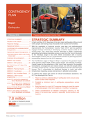
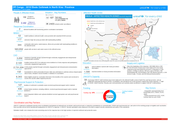
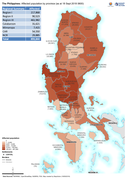
In April and May 2015, Nepal was hit by two major earthquakes killing around 9,000 people and leaving many thousands more injured and homeless.
To optimize the speed and volume of critical humanitarian assistance, the HCT has developed this Plan to:
1. Reach a common understanding of earth ... quake risk to ensure early action is taken when required.
2. Establish a minimum level of earthquake preparedness across clusters.
3. Build the basis for a joint HCT response strategy to meet the needs of affected people in the first 6 weeks to 3 months of a response.
4. Define considerations for detailed contingency planning on the basis of the worst-case scenario, especially around access and logistics. more
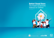
The report examines some of the underlying causes of domestic violence and the impact on children of being exposed to violence in the home.
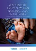
To complement the Global Strategy progress reporting, this report provides a detailed look at country leadership and action toward the Every Newborn National Milestones by 2020. Countries have taken the initiative to show the way forward and have demonstrated significant progress. As part of monitor
...
ing this progress, countries have adopted the Every Newborn Tracking Tool. This report presents a compilation of the data collated by the Every Newborn Tracking Tool in 2016, when 51 countries adopted the tool; it also spotlights examples of specific country activity for each National Milestone. Finally, Global Milestones for 2020 were part of the Every Newborn Action Plan to guide global and regional work in support of country efforts and this report highlights relevant progress towards those Global Milestones.
more
UNICEF CHILD ALERT May 2018
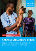
As part of a UNICEF series highlighting the challenges faced by children in current crisis situations, this Child Alert examines the situation of children affected by violent conflict in Kasai region, Democratic Republic of the Congo. The alert outlines what UNICEF a ... nd its partners have achieved to date in providing humanitarian assistance to children in Kasai affected by malnutrition and lack of access to health care, safe water and education. It calls upon all parties to the conflict – and the international community – to take urgent action protecting the lives and futures of children at risk, before it is too late. more
As part of a UNICEF series highlighting the challenges faced by children in current crisis situations, this Child Alert examines the situation of children affected by violent conflict in Kasai region, Democratic Republic of the Congo. The alert outlines what UNICEF a ... nd its partners have achieved to date in providing humanitarian assistance to children in Kasai affected by malnutrition and lack of access to health care, safe water and education. It calls upon all parties to the conflict – and the international community – to take urgent action protecting the lives and futures of children at risk, before it is too late. more
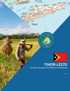
Timor-Leste’s vulnerability to natural hazards means if particular care is not taken in the development of the country’s infrastructure, it will remain at risk to disruption.
Timor-Leste developed the 2008 National Disaster Risk Management Policy, which lays out the government’s vison of ... its disaster management process from the national to the village level. Additionally, through the United Nations Development Program (UNDP), they have conducted national hazards, vulnerability and risk assessments. Through Plan International they have initiated the integration of disaster management education into public schools. Although the Government of Timor-Leste considers DRM as a priority and supports the dissemination of DRM policy to the district levels, the current Strategic Development Plan 2011-2030 of Timor-Leste has not explicitly reflected nor integrated DRM as one of its development priorities. Disaster Management is included in the Strategic Plan Document of MSS 2009-2012. more
Timor-Leste developed the 2008 National Disaster Risk Management Policy, which lays out the government’s vison of ... its disaster management process from the national to the village level. Additionally, through the United Nations Development Program (UNDP), they have conducted national hazards, vulnerability and risk assessments. Through Plan International they have initiated the integration of disaster management education into public schools. Although the Government of Timor-Leste considers DRM as a priority and supports the dissemination of DRM policy to the district levels, the current Strategic Development Plan 2011-2030 of Timor-Leste has not explicitly reflected nor integrated DRM as one of its development priorities. Disaster Management is included in the Strategic Plan Document of MSS 2009-2012. more
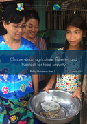
Policy Guidance Brief 1
• Climate change has already challenged the agriculture sector in Myanmar by afecting rice yields and livestock production, while disasters such as foods and cyclones have caused massive destruction in rural areas.
• Without adaptation, the long-term consequenc ... es of climate change will likely include reduced productivity and huge economic losses, food insecurity, poverty and migration.
• According to the Climate Change Action Plan for the Agriculture, Fisheries and Livestock sector, by 2030 Myanmar should achieve climate-resilient productivity and promote climate-smart responses to support food security and livelihood strategies while also introducing resource-efficient and lowcarbon practices. more
Armed conflict continues to tear apart communities across the world. From Boko Haram’s abducted ‘brides’ and Islamic State’s ‘Caliphate Cubs’, to the countless others exploited by armed groups in Democratic Republic of Congo, South Sudan and Afghanistan, many taking part in the world’s
...
wars are still children.
more
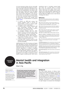
This brief report examines the extent to which community-based treatment and integration support are provided for people living with mental illness across 15 selected Asia-Pacific economies. Some of the key findings are discussed in light of the diversity of economies and cultural contexts.
BJPSYCH
...
INTERNATIONALVOLUME 15 NUMBER 4 NOVEMBER 201
more
Всемирный доклад о наркотиках 2016 года публикуется по завершении знаменательного события в истории глобальной политики в отношении наркотиков – специальной сесс�
...
�и Генеральной Ассамблеи по мировой проблеме наркотиков. В главе I представлен общий обзор ситуации с предложением опиатов, кокаина, каннабиса, стимуляторов амфетаминового ряда (САР) и новых психоактивных веществ (НПВ) и спросом на них, а также их воздействия на здоровье человека. В ней рассматриваются также научные данные о полинаркомании, обращаемости за лечением в связи с потреблением каннабиса и изменениях, произошедших после легализации потребления каннабиса в рекреационных целях в некоторых районах мира. Глава II сосредоточена на рассмотрении механизмов взаимодействия мировой проблемы наркотиков и всех аспектов устойчивого развития через призму целей в области устойчивого развития.
more
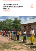
The Government of Republic of Zambia reported the first confirmed cases of COVID-19 on 18th March 2020. As of April 27th, 2020, there were 89 confirmed cases, three deaths and 42 recoveries. Confirmed cases are located in three provinces: Lusaka (83 cases), Copperbelt province (5 cases) and Central
...
(1 case). Zambia introduced a series of measures including closure of three international airports, closure of all schools, movement restrictions and closure of non-essential services such as restaurant, bar, gym and public gatherings to curb the transmission rate.
more