Filter
431
Text search:
interactive
map
Featured
50
115
Language
Document type
237
74
34
31
16
12
10
5
4
4
3
1
Countries
24
16
14
13
11
10
10
9
9
9
8
7
7
6
6
5
5
5
5
5
4
4
4
4
4
4
4
4
3
3
3
3
3
3
3
3
3
3
2
2
2
2
2
2
2
2
2
2
2
2
1
1
1
1
1
1
1
1
1
1
1
1
1
1
1
1
1
1
1
1
1
1
1
1
1
1
1
Authors & Publishers
Publication Years
Category
126
34
31
22
20
19
2
2
Toolboxes
35
33
31
23
23
15
13
12
11
10
10
9
9
9
8
7
6
3
3
3
3
2
This module carries pre-training entry level assessment as well as hands on exercise manual on Geographic Information Systems, Remote Sensing, Geographic Positioning System (GPS) and some applications of these technologies on Disaster Risk Management (DRM) especially for hazard mapping, monitoring a
...
Tracking the Ebola Outbreak (interactive map)
recommended
Interactive Map, please click on: website link:
https://devseed-dev.firebaseapp.com/
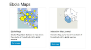
Now available in an interactive map journal that shows the evolution of the outbreak and the global response. Please download the latest version from the website
http://apps.who.int/ebola/en/curr
...
This guide is an introduction on how to integrate logistics management information systems (LMIS) with geographic information systems (GIS). It covers the value of integrating these two systems, the steps in assessing if it is currently viable to link the systems, how to set the linkage, the process
...

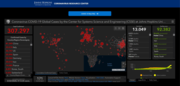
John Hopkins COVID-19 map
recommended
Interactive Map
You’ve probably noticed that the map has been evolving along with the virus. Now, it sports new layers of data—including a clo
...
A manual intended for use by Men As Partners (MAP) educators in facilitating workshops on male involvement in reproductive health. Contains a variety of interactive educational activities on such to
...
The spread of COVID-19 poses a challenge for emerging markets such as those in Africa and Latin America. While governments around the world are suffering from a shortage of ventilators, hospital beds, and personal protective equipment, availability of these items is already extremely limited in some
...
The school and a community teaching modules are aimed at preventing vector-borne diseases through community participation. Meanwhile, the interactive toolkit is meant to be help raise awareness on health, sanitation and vector control. These materia
...
This companion document to Ending the neglect to attain the Sustainable Development Goals: a road map for neglected tropical diseases 2021-2030 ("the road map") aims to support a range of stakeholde
...
Accessed on 06.03.2022
This interactive tool provides a snapshot – in the form of a map – of current national air quality standards for classical pollutants (particulate matter, nitrogen d
...
On 23 March 2014 WHO’s African Regional Office reported an outbreak of Ebola virus disease in Guinea. Since then cases have been reported in 5 additional West African countries. This interactive timeline links to key events, stories and further re
...
In the post-colonial history of the Central African Republic, violence has often been the shortest way to presidential power. President Bozizé presented little deviation from this narrative after coming to power after a coup d’état in 2003. Whilst he faced armed opposition and a conflict-affecte
...
Interactive Dashboard: Climate; Hunger & Economic Explorer
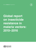
As of October 2017, the global database comprised almost 30 000 records, including results from bioassays to measure phenotypic resistance, and biochemical and molecular tests for resistance mechanisms. The current report presents an overview of data on malaria vector resistance for 2010 to 2016. It
...
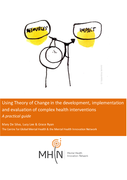
This guide provides a practical overview of the process of developing a Theory of Change, focusing on using a stakeholder-driven, workshop approach to achieve this.